Confort geodata
Confort (Auvergne-Rhône-Alpes) is a populated place; located in France in Europe/Paris (GMT+2) time zone. With population of 543 people, there are 14333 cities with bigger population in this country. Compared to other cities in France, 64.3% of cities are located further ↑North; 85.3% of cities are located further ←West and 94.5% of cities have lower elevation than Confort. Note1
Administrative division(s):
- Level 1: Auvergne-Rhône-Alpes
- Level 2: Département de l'Ain
- Level 3: Arrondissement de Nantua
- Level 4: Confort


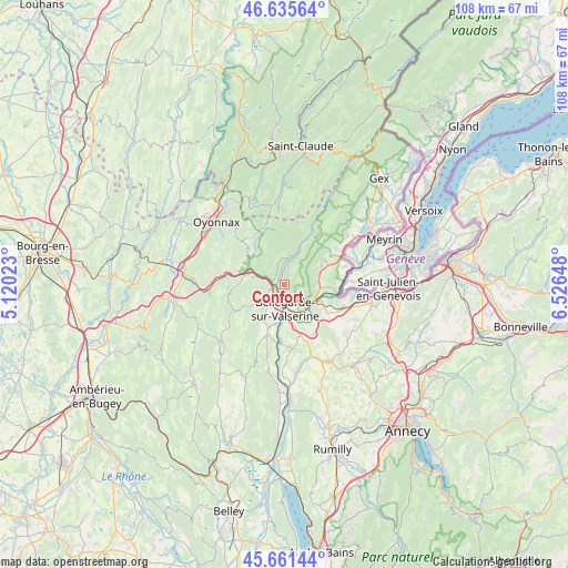
Confort GPS coordinates[2]
46° 9' 2.52" North, 5° 49' 24.06" East
| Map corner | latitude | longitude |
|---|---|---|
| Upper-left | 46.63564°, | 5.12023° |
| Center: | 46.1507°, | 5.82335° |
| Lower-right: | 45.66144°, | 6.52648° |
| Map W x H: | 108.3×108.3 km | = 67.3×67.3mi |
| max Lat: | 51.07786° ⇑64.3% North |
| Confort: | 46.1507° |
| min Lat: | ⇓35.7% South 41.3874° |
| min Long | Confort | max Long |
| -5.08615° | 5.82335° | 9.52242° |
| W 85.3%⇐ | ⇒14.7% E |
Elevation
Elevation of Confort is 561 m = 1841 ft, and this is 367.3 m = 1205 ft above average elevation for this country.
| Max E: |
2333 m = 7654 ft | 5.5% |
| Confort | 561 m 1841 ft | |
| Avg. | 193.7 m = 635 ft | |
Min E: |
-1 m = -3 ft | 94.5% |
See also: France elevation on elevation.city.
Geographical zone
Confort is located in North temperate zone (between Tropic of Cancer and the Arctic Circle). Distance of this North polar circle is 2269.7 km =1410.3 mi to North.| Distance of | km | miles | from Confort |
|---|---|---|---|
| North Pole | 4875.6 | 3029.6 | to North |
| Arctic Circle | 2269.7 | 1410.3 | to North |
| Tropic Cancer | 2525.6 | 1569.3 | to South |
| Equator | 5131.5 | 3188.6 | to South |


Nearby cities:
15 places around Confort: (largest is in red/bold)
• Bellegarde-sur-Valserine
4.8 km =3 mi,  179°
179°
• Champfromier
4.8 km =3 mi,  351°
351°
• Châtillon-en-Michaille
2 km =1.2 mi,  245°
245°
• Collonges
6.4 km =4 mi,  102°
102°
• Farges
6.5 km =4 mi,  73°
73°
• Génissiat
11 km =6.8 mi,  188°
188°
• Lancrans
2.7 km =1.7 mi,  164°
164°
• Léaz
7.4 km =4.6 mi,  142°
142°
• Pougny
9.8 km =6.1 mi, 97°
• Péron
9 km =5.6 mi,  60°
60°
• Saint-Germain-de-Joux
7.3 km =4.5 mi,  295°
295°
• Saint-Jean-de-Gonville
12 km =7.5 mi,  54°
54°
• Valleiry
12.2 km =7.6 mi,  111°
111°
• Vulbens
10.1 km =6.3 mi,  122°
122°
• Éloise
8.3 km =5.2 mi, 159°
Sources, notices
• [Note1] Compared only with cities in France existing in our database
• [Src1] Map data: © OpenStreetMap contributors (CC-BY-SA)
• [Src2] Other city data from geonames.org with taken over terms of usage.
• [Src3] Geographical zone / Annual Mean Temperature by Robert A. Rohde @ Wikipedia
