Lancrans geodata
Lancrans (Auvergne-Rhône-Alpes) is a populated place; located in France in Europe/Paris (GMT+2) time zone. With population of 1,019 people, there are 8696 cities with bigger population in this country. Compared to other cities in France, 64.7% of cities are located further ↑North; 85.4% of cities are located further ←West and 93% of cities have lower elevation than Lancrans. Note1
Administrative division(s):
- Level 1: Auvergne-Rhône-Alpes
- Level 2: Département de l'Ain
- Level 3: Arrondissement de Nantua
- Level 4: Valserhône


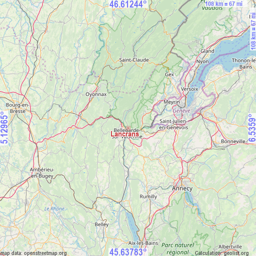
Lancrans GPS coordinates[2]
46° 7' 38.244" North, 5° 49' 57.972" East
| Map corner | latitude | longitude |
|---|---|---|
| Upper-left | 46.61244°, | 5.12965° |
| Center: | 46.12729°, | 5.83277° |
| Lower-right: | 45.63783°, | 6.5359° |
| Map W x H: | 108.4×108.4 km | = 67.4×67.4mi |
| max Lat: | 51.07786° ⇑64.7% North |
| Lancrans: | 46.12729° |
| min Lat: | ⇓35.3% South 41.3874° |
| min Long | Lancrans | max Long |
| -5.08615° | 5.83277° | 9.52242° |
| W 85.4%⇐ | ⇒14.6% E |
Elevation
Elevation of Lancrans is 503 m = 1650 ft, and this is 309.3 m = 1015 ft above average elevation for this country.
| Max E: |
2333 m = 7654 ft | 7% |
| Lancrans | 503 m 1650 ft | |
| Avg. | 193.7 m = 635 ft | |
Min E: |
-1 m = -3 ft | 93% |
See also: France elevation on elevation.city.
Geographical zone
Lancrans is located in North temperate zone (between Tropic of Cancer and the Arctic Circle). Distance of this North polar circle is 2272.3 km =1411.9 mi to North.| Distance of | km | miles | from Lancrans |
|---|---|---|---|
| North Pole | 4878.2 | 3031.2 | to North |
| Arctic Circle | 2272.3 | 1411.9 | to North |
| Tropic Cancer | 2523 | 1567.7 | to South |
| Equator | 5128.9 | 3186.9 | to South |


Nearby cities:
15 places around Lancrans: (largest is in red/bold)
• Bellegarde-sur-Valserine
2.3 km =1.4 mi,  196°
196°
• Champfromier
7.5 km =4.7 mi,  348°
348°
• Châtillon-en-Michaille
3.1 km =1.9 mi,  304°
304°
• Collonges
5.7 km =3.5 mi,  77°
77°
• Confort
2.7 km =1.7 mi,  344°
344°
• Farges
7.1 km =4.4 mi,  51°
51°
• Génissiat
8.6 km =5.3 mi, 195°
• Léaz
5 km =3.1 mi,  130°
130°
• Pougny
9.1 km =5.7 mi, 81°
• Péron
10 km =6.2 mi, 45°
• Saint-Germain-de-Joux
9.3 km =5.8 mi,  308°
308°
• Savigny
11.4 km =7.1 mi, 125°
• Valleiry
10.8 km =6.7 mi,  99°
99°
• Vulbens
8.3 km =5.2 mi,  110°
110°
• Éloise
5.6 km =3.5 mi,  157°
157°
Sources, notices
• [Note1] Compared only with cities in France existing in our database
• [Src1] Map data: © OpenStreetMap contributors (CC-BY-SA)
• [Src2] Other city data from geonames.org with taken over terms of usage.
• [Src3] Geographical zone / Annual Mean Temperature by Robert A. Rohde @ Wikipedia
