Saint-Eusèbe geodata
Saint-Eusèbe (Bourgogne-Franche-Comté) is a populated place; located in France in Europe/Paris (GMT+2) time zone. With population of 1,081 people, there are 8251 cities with bigger population in this country. Compared to other cities in France, 58.1% of cities are located further ↑North; 71.8% of cities are located further ←West and 84.8% of cities have lower elevation than Saint-Eusèbe. Note1
Administrative division(s):
- Level 1: Bourgogne-Franche-Comté
- Level 2: Département de Saône-et-Loire
- Level 3: Autun
- Level 4: Saint-Eusèbe


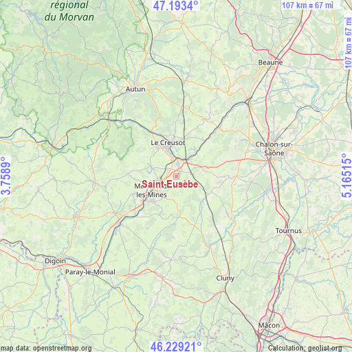
Saint-Eusèbe GPS coordinates[2]
46° 42' 48.456" North, 4° 27' 43.308" East
| Map corner | latitude | longitude |
|---|---|---|
| Upper-left | 47.1934°, | 3.7589° |
| Center: | 46.71346°, | 4.46203° |
| Lower-right: | 46.22921°, | 5.16515° |
| Map W x H: | 107.2×107.2 km | = 66.6×66.6mi |
| max Lat: | 51.07786° ⇑58.1% North |
| Saint-Eusèbe: | 46.71346° |
| min Lat: | ⇓41.9% South 41.3874° |
| min Long | Saint-Eusèbe | max Long |
| -5.08615° | 4.46203° | 9.52242° |
| W 71.8%⇐ | ⇒28.2% E |
Elevation
Elevation of Saint-Eusèbe is 344 m = 1129 ft, and this is 150.3 m = 493 ft above average elevation for this country.
| Max E: |
2333 m = 7654 ft | 15.2% |
| Saint-Eusèbe | 344 m 1129 ft | |
| Avg. | 193.7 m = 635 ft | |
Min E: |
-1 m = -3 ft | 84.8% |
See also: France elevation on elevation.city.
Geographical zone
Saint-Eusèbe is located in North temperate zone (between Tropic of Cancer and the Arctic Circle). Distance of this North polar circle is 2207.1 km =1371.4 mi to North.| Distance of | km | miles | from Saint-Eusèbe |
|---|---|---|---|
| North Pole | 4813 | 2990.7 | to North |
| Arctic Circle | 2207.1 | 1371.4 | to North |
| Tropic Cancer | 2588.1 | 1608.2 | to South |
| Equator | 5194 | 3227.4 | to South |


Nearby cities:
15 places around Saint-Eusèbe: (largest is in red/bold)
• Blanzy
5.8 km =3.6 mi,  255°
255°
• Gourdon
8.1 km =5 mi,  188°
188°
• Le Breuil
10.4 km =6.5 mi,  3°
3°
• Le Creusot
11 km =6.8 mi,  341°
341°
• Montceau-les-Mines
8.9 km =5.5 mi,  234°
234°
• Montcenis
10 km =6.2 mi,  325°
325°
• Montchanin
4.1 km =2.5 mi,  9°
9°
• Pouilloux
14.1 km =8.8 mi,  213°
213°
• Saint-Berain-sous-Sanvignes
12.8 km =8 mi,  266°
266°
• Saint-Firmin
12.9 km =8 mi, 2°
• Saint-Leu
3.5 km =2.2 mi,  57°
57°
• Saint-Vallier
10.6 km =6.6 mi,  220°
220°
• Sanvignes-les-Mines
14.1 km =8.8 mi,  247°
247°
• Torcy
6.2 km =3.9 mi,  353°
353°
• Écuisses
7.5 km =4.7 mi,  50°
50°
Sources, notices
• [Note1] Compared only with cities in France existing in our database
• [Src1] Map data: © OpenStreetMap contributors (CC-BY-SA)
• [Src2] Other city data from geonames.org with taken over terms of usage.
• [Src3] Geographical zone / Annual Mean Temperature by Robert A. Rohde @ Wikipedia
