Écuisses geodata
Écuisses (Bourgogne-Franche-Comté) is a populated place; located in France in Europe/Paris (GMT+2) time zone. With population of 1,686 people, there are 5559 cities with bigger population in this country. Compared to other cities in France, 57.6% of cities are located further ↑North; 72.3% of cities are located further ←West and 84.9% of cities have lower elevation than Écuisses. Note1
Administrative division(s):
- Level 1: Bourgogne-Franche-Comté
- Level 2: Département de Saône-et-Loire
- Level 3: Autun
- Level 4: Écuisses


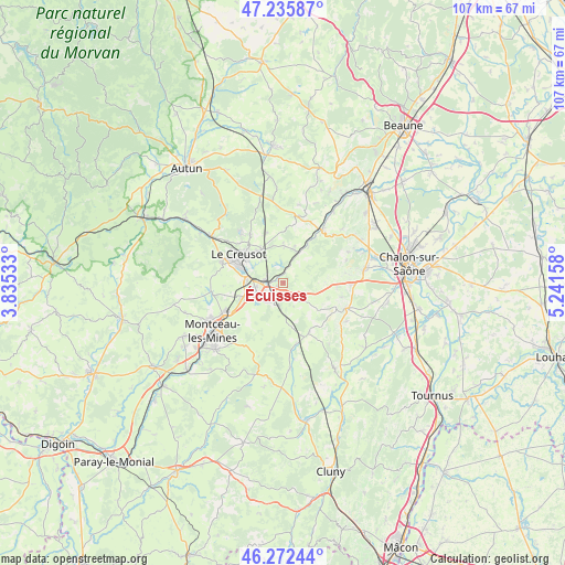
Écuisses GPS coordinates[2]
46° 45' 22.716" North, 4° 32' 18.42" East
| Map corner | latitude | longitude |
|---|---|---|
| Upper-left | 47.23587°, | 3.83533° |
| Center: | 46.75631°, | 4.53845° |
| Lower-right: | 46.27244°, | 5.24158° |
| Map W x H: | 107.1×107.1 km | = 66.5×66.5mi |
| max Lat: | 51.07786° ⇑57.6% North |
| Écuisses: | 46.75631° |
| min Lat: | ⇓42.4% South 41.3874° |
| min Long | Écuisses | max Long |
| -5.08615° | 4.53845° | 9.52242° |
| W 72.3%⇐ | ⇒27.7% E |
Elevation
Elevation of Écuisses is 345 m = 1132 ft, and this is 151.3 m = 496 ft above average elevation for this country.
| Max E: |
2333 m = 7654 ft | 15.1% |
| Écuisses | 345 m 1132 ft | |
| Avg. | 193.7 m = 635 ft | |
Min E: |
-1 m = -3 ft | 84.9% |
See also: France elevation on elevation.city.
Geographical zone
Écuisses is located in North temperate zone (between Tropic of Cancer and the Arctic Circle). Distance of this North polar circle is 2202.4 km =1368.5 mi to North.| Distance of | km | miles | from Écuisses |
|---|---|---|---|
| North Pole | 4808.2 | 2987.7 | to North |
| Arctic Circle | 2202.4 | 1368.5 | to North |
| Tropic Cancer | 2592.9 | 1611.2 | to South |
| Equator | 5198.8 | 3230.4 | to South |


Nearby cities:
15 places around Écuisses: (largest is in red/bold)
• Blanzy
13 km =8.1 mi,  241°
241°
• Couches
12.5 km =7.8 mi,  9°
9°
• Le Breuil
7.7 km =4.8 mi,  316°
316°
• Le Creusot
10.9 km =6.8 mi,  301°
301°
• Montcenis
12 km =7.5 mi,  286°
286°
• Montchanin
5.2 km =3.2 mi,  261°
261°
• Moroges
10.6 km =6.6 mi,  93°
93°
• Saint-Désert
13.1 km =8.1 mi, 90°
• Saint-Eusèbe
7.5 km =4.7 mi,  230°
230°
• Saint-Firmin
9.7 km =6 mi,  326°
326°
• Saint-Leu
4 km =2.5 mi, 225°
• Saint-Léger-sur-Dheune
12.4 km =7.7 mi,  36°
36°
• Saint-Pierre-de-Varennes
10 km =6.2 mi,  342°
342°
• Saint-Sernin-du-Bois
12.4 km =7.7 mi, 319°
• Torcy
6.6 km =4.1 mi,  281°
281°
Sources, notices
• [Note1] Compared only with cities in France existing in our database
• [Src1] Map data: © OpenStreetMap contributors (CC-BY-SA)
• [Src2] Other city data from geonames.org with taken over terms of usage.
• [Src3] Geographical zone / Annual Mean Temperature by Robert A. Rohde @ Wikipedia
