Corcoué-sur-Logne geodata
Corcoué-sur-Logne (Pays de la Loire) is a populated place; located in France in Europe/Paris (GMT+2) time zone. With population of 2,480 people, there are 3916 cities with bigger population in this country. Compared to other cities in France, 55.7% of cities are located further ↑North; 92.8% of cities are located further →East and 85.3% of cities have higher elevation than Corcoué-sur-Logne. Note1
Administrative division(s):
- Level 1: Pays de la Loire
- Level 2: Loire-Atlantique
- Level 3: Arrondissement de Nantes
- Level 4: Corcoué-sur-Logne


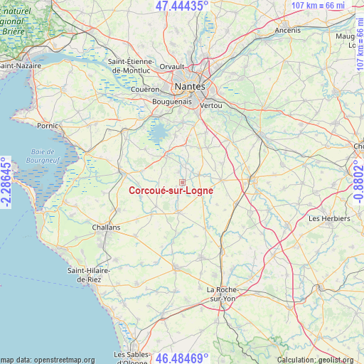
Corcoué-sur-Logne GPS coordinates[2]
46° 58' 0.012" North, 1° 34' 59.988" West
| Map corner | latitude | longitude |
|---|---|---|
| Upper-left | 47.44435°, | -2.28645° |
| Center: | 46.96667°, | -1.58333° |
| Lower-right: | 46.48469°, | -0.8802° |
| Map W x H: | 106.7×106.7 km | = 66.3×66.3mi |
| max Lat: | 51.07786° ⇑55.7% North |
| Corcoué-sur-Logne: | 46.96667° |
| min Lat: | ⇓44.3% South 41.3874° |
| min Long | Corcoué-sur-Lo | max Long |
| -5.08615° | -1.58333° | 9.52242° |
| W 7.2%⇐ | ⇒92.8% E |
Elevation
Elevation of Corcoué-sur-Logne is 41 m = 135 ft, and this is 152.7 m = 501 ft below average elevation for this country.
| Max E: |
2333 m = 7654 ft | 85.3% |
| Avg. | 193.7 m = 635 ft | |
| Corcoué-sur-Logne | 41 m = 135 ft | |
Min E: |
-1 m = -3 ft | 14.7% |
See also: France elevation on elevation.city.
Geographical zone
Corcoué-sur-Logne is located in North temperate zone (between Tropic of Cancer and the Arctic Circle). Distance of this North polar circle is 2179 km =1354 mi to North.| Distance of | km | miles | from Corcoué-sur-Logne |
|---|---|---|---|
| North Pole | 4784.9 | 2973.2 | to North |
| Arctic Circle | 2179 | 1354 | to North |
| Tropic Cancer | 2616.3 | 1625.7 | to South |
| Equator | 5222.2 | 3244.9 | to South |


Nearby cities:
15 places around Corcoué-sur-Logne: (largest is in red/bold)
• Falleron
13.1 km =8.1 mi,  223°
223°
• Geneston
11.4 km =7.1 mi,  28°
28°
• La Chevrolière
14 km =8.7 mi,  351°
351°
• La Limouzinière
3.1 km =1.9 mi,  340°
340°
• La Planche
12.8 km =8 mi,  64°
64°
• Legé
9.2 km =5.7 mi,  188°
188°
• Montbert
12.3 km =7.6 mi,  35°
35°
• Paulx
13.1 km =8.1 mi,  267°
267°
• Rocheservière
6.3 km =3.9 mi,  120°
120°
• Saint-André-Treize-Voies
13.5 km =8.4 mi,  105°
105°
• Saint-Philbert-de-Bouaine
5.2 km =3.2 mi,  66°
66°
• Saint-Philbert-de-Grand-Lieu
8.9 km =5.5 mi,  330°
330°
• Saint-Étienne-de-Mer-Morte
12.8 km =8 mi,  250°
250°
• Touvois
10.5 km =6.5 mi,  226°
226°
• Vieillevigne
11.3 km =7 mi,  86°
86°
Sources, notices
• [Note1] Compared only with cities in France existing in our database
• [Src1] Map data: © OpenStreetMap contributors (CC-BY-SA)
• [Src2] Other city data from geonames.org with taken over terms of usage.
• [Src3] Geographical zone / Annual Mean Temperature by Robert A. Rohde @ Wikipedia
