Sainte-Anastasie-sur-Issole geodata
Sainte-Anastasie-sur-Issole (Provence-Alpes-Côte d'Azur) is a populated place; located in France in Europe/Paris (GMT+2) time zone. With population of 1,667 people, there are 5617 cities with bigger population in this country. Compared to other cities in France, 95% of cities are located further ↑North; 88.5% of cities are located further ←West and 80.8% of cities have lower elevation than Sainte-Anastasie-sur-Issole. Note1
Administrative division(s):
- Level 1: Provence-Alpes-Côte d'Azur
- Level 2: Var
- Level 3: Arrondissement de Brignoles
- Level 4: Sainte-Anastasie-sur-Issole
Current local time in Sainte-Anastasie-sur-Issole:
06:04 AM, WednesdayDifference from your time zone: hours


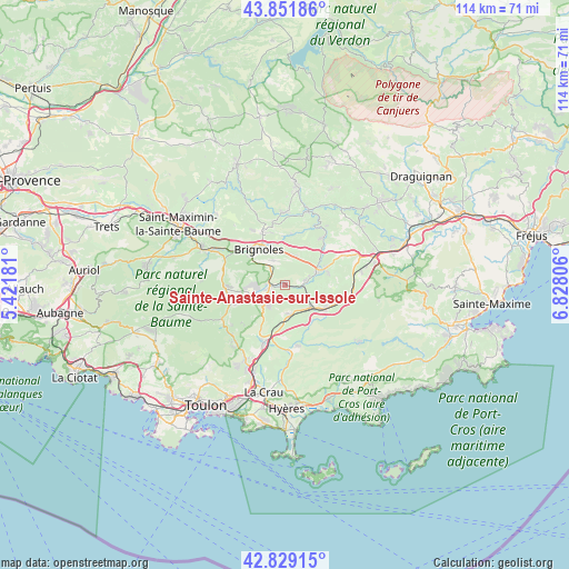
Sainte-Anastasie-sur-Issole GPS coordinates[2]
43° 20' 33.576" North, 6° 7' 29.748" East
| Map corner | latitude | longitude |
|---|---|---|
| Upper-left | 43.85186°, | 5.42181° |
| Center: | 43.34266°, | 6.12493° |
| Lower-right: | 42.82915°, | 6.82806° |
| Map W x H: | 113.7×113.7 km | = 70.6×70.6mi |
| max Lat: | 51.07786° ⇑95% North |
| Sainte-Anastasie-sur-Issole: | 43.34266° |
| min Lat: | ⇓5% South 41.3874° |
| min Long | Sainte-Anastasi | max Long |
| -5.08615° | 6.12493° | 9.52242° |
| W 88.5%⇐ | ⇒11.5% E |
Elevation
Elevation of Sainte-Anastasie-sur-Issole is 299 m = 981 ft, and this is 105.3 m = 345 ft above average elevation for this country.
| Max E: |
2333 m = 7654 ft | 19.2% |
| Sainte-Anastasie-sur-Issole | 299 m 981 ft | |
| Avg. | 193.7 m = 635 ft | |
Min E: |
-1 m = -3 ft | 80.8% |
See also: France elevation on elevation.city.
Geographical zone
Sainte-Anastasie-sur-Issole is located in North temperate zone (between Tropic of Cancer and the Arctic Circle). Distance of this Northern Tropic circle is 2213.3 km =1375.3 mi to South.| Distance of | km | miles | from Sainte-Anastasie-sur-Issole |
|---|---|---|---|
| North Pole | 5187.8 | 3223.5 | to North |
| Arctic Circle | 2581.9 | 1604.3 | to North |
| Tropic Cancer | 2213.3 | 1375.3 | to South |
| Equator | 4819.3 | 2994.6 | to South |


Nearby cities:
15 places around Sainte-Anastasie-sur-Issole: (largest is in red/bold)
• Besse-sur-Issole
4.2 km =2.6 mi,  80°
80°
• Brignoles
8.7 km =5.4 mi,  323°
323°
• Cabasse
12 km =7.5 mi,  39°
39°
• Camps-la-Source
5.4 km =3.4 mi,  334°
334°
• Carnoules
6.8 km =4.2 mi,  131°
131°
• Flassans-sur-Issole
8.3 km =5.2 mi,  69°
69°
• Forcalqueiret
3.4 km =2.1 mi,  257°
257°
• Garéoult
6.6 km =4.1 mi, 255°
• La Celle
9.2 km =5.7 mi,  309°
309°
• Le Val
11.5 km =7.1 mi,  338°
338°
• Néoules
10.2 km =6.3 mi,  248°
248°
• Pignans
9.4 km =5.8 mi,  119°
119°
• Puget-Ville
6 km =3.7 mi,  171°
171°
• Rocbaron
5.2 km =3.2 mi,  224°
224°
• Vins-sur-Caramy
10.3 km =6.4 mi,  7°
7°
Sources, notices
• [Note1] Compared only with cities in France existing in our database
• [Src1] Map data: © OpenStreetMap contributors (CC-BY-SA)
• [Src2] Other city data from geonames.org with taken over terms of usage.
• [Src3] Geographical zone / Annual Mean Temperature by Robert A. Rohde @ Wikipedia
