Saint-Christophe-sur-Guiers geodata
Saint-Christophe-sur-Guiers (Auvergne-Rhône-Alpes) is a populated place; located in France in Europe/Paris (GMT+2) time zone. With population of 782 people, there are 10798 cities with bigger population in this country. Compared to other cities in France, 74.8% of cities are located further ↑North; 84.9% of cities are located further ←West and 89.8% of cities have lower elevation than Saint-Christophe-sur-Guiers. Note1
Administrative division(s):
- Level 1: Auvergne-Rhône-Alpes
- Level 2: Département de l'Isère
- Level 3: Arrondissement de Grenoble
- Level 4: Saint-Christophe-sur-Guiers
Current local time in Saint-Christophe-sur-Guiers:
11:26 AM, SaturdayDifference from your time zone: hours


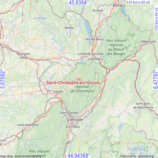
Saint-Christophe-sur-Guiers GPS coordinates[2]
45° 26' 21.12" North, 5° 46' 26.22" East
| Map corner | latitude | longitude |
|---|---|---|
| Upper-left | 45.9304°, | 5.07082° |
| Center: | 45.4392°, | 5.77395° |
| Lower-right: | 44.94368°, | 6.47707° |
| Map W x H: | 109.7×109.7 km | = 68.2×68.2mi |
| max Lat: | 51.07786° ⇑74.8% North |
| Saint-Christophe-sur-Guiers: | 45.4392° |
| min Lat: | ⇓25.2% South 41.3874° |
| min Long | Saint-Christoph | max Long |
| -5.08615° | 5.77395° | 9.52242° |
| W 84.9%⇐ | ⇒15.1% E |
Elevation
Elevation of Saint-Christophe-sur-Guiers is 421 m = 1381 ft, and this is 227.3 m = 746 ft above average elevation for this country.
| Max E: |
2333 m = 7654 ft | 10.2% |
| Saint-Christophe-sur-Guiers | 421 m 1381 ft | |
| Avg. | 193.7 m = 635 ft | |
Min E: |
-1 m = -3 ft | 89.8% |
See also: France elevation on elevation.city.
Geographical zone
Saint-Christophe-sur-Guiers is located in North temperate zone (between Tropic of Cancer and the Arctic Circle). Distance of this North polar circle is 2348.8 km =1459.5 mi to North.| Distance of | km | miles | from Saint-Christophe-sur-Guiers |
|---|---|---|---|
| North Pole | 4954.7 | 3078.7 | to North |
| Arctic Circle | 2348.8 | 1459.5 | to North |
| Tropic Cancer | 2446.4 | 1520.1 | to South |
| Equator | 5052.4 | 3139.4 | to South |


Nearby cities:
15 places around Saint-Christophe-sur-Guiers: (largest is in red/bold)
• Attignat-Oncin
7.7 km =4.8 mi,  1°
1°
• Entre-Deux-Guiers
2 km =1.2 mi,  240°
240°
• Entremont-le-Vieux
8.6 km =5.3 mi,  94°
94°
• La Bridoire
9.9 km =6.2 mi,  344°
344°
• Les Échelles
2 km =1.2 mi,  274°
274°
• Miribel-les-Échelles
5.2 km =3.2 mi,  260°
260°
• Saint-Aupre
9.3 km =5.8 mi, 244°
• Saint-Bueil
8 km =5 mi,  301°
301°
• Saint-Béron
8 km =5 mi,  333°
333°
• Saint-Geoire-en-Valdaine
11 km =6.8 mi,  280°
280°
• Saint-Joseph-de-Rivière
9.3 km =5.8 mi,  220°
220°
• Saint-Laurent-du-Pont
6.1 km =3.8 mi,  211°
211°
• Saint-Pierre-de-Chartreuse
11.2 km =7 mi,  163°
163°
• Saint-Thibaud-de-Couz
8.8 km =5.5 mi,  38°
38°
• Saint-Étienne-de-Crossey
12.1 km =7.5 mi, 237°
Sources, notices
• [Note1] Compared only with cities in France existing in our database
• [Src1] Map data: © OpenStreetMap contributors (CC-BY-SA)
• [Src2] Other city data from geonames.org with taken over terms of usage.
• [Src3] Geographical zone / Annual Mean Temperature by Robert A. Rohde @ Wikipedia
