Saint-Aupre geodata
Saint-Aupre (Auvergne-Rhône-Alpes) is a populated place; located in France in Europe/Paris (GMT+2) time zone. With population of 1,059 people, there are 8406 cities with bigger population in this country. Compared to other cities in France, 75.2% of cities are located further ↑North; 84.2% of cities are located further ←West and 95.6% of cities have lower elevation than Saint-Aupre. Note1
Administrative division(s):
- Level 1: Auvergne-Rhône-Alpes
- Level 2: Département de l'Isère
- Level 3: Arrondissement de Grenoble
- Level 4: Saint-Aupre


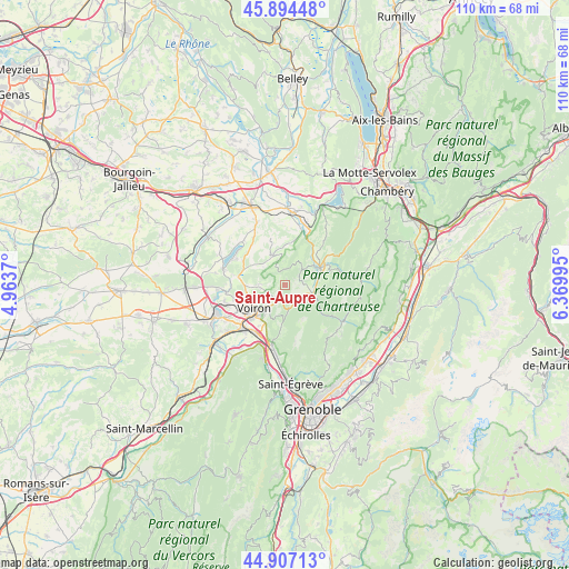
Saint-Aupre GPS coordinates[2]
45° 24' 10.656" North, 5° 40' 0.552" East
| Map corner | latitude | longitude |
|---|---|---|
| Upper-left | 45.89448°, | 4.9637° |
| Center: | 45.40296°, | 5.66682° |
| Lower-right: | 44.90713°, | 6.36995° |
| Map W x H: | 109.8×109.8 km | = 68.2×68.2mi |
| max Lat: | 51.07786° ⇑75.2% North |
| Saint-Aupre: | 45.40296° |
| min Lat: | ⇓24.8% South 41.3874° |
| min Long | Saint-Aupre | max Long |
| -5.08615° | 5.66682° | 9.52242° |
| W 84.2%⇐ | ⇒15.8% E |
Elevation
Elevation of Saint-Aupre is 614 m = 2014 ft, and this is 420.3 m = 1379 ft above average elevation for this country.
| Max E: |
2333 m = 7654 ft | 4.4% |
| Saint-Aupre | 614 m 2014 ft | |
| Avg. | 193.7 m = 635 ft | |
Min E: |
-1 m = -3 ft | 95.6% |
See also: France elevation on elevation.city.
Geographical zone
Saint-Aupre is located in North temperate zone (between Tropic of Cancer and the Arctic Circle). Distance of this North polar circle is 2352.8 km =1462 mi to North.| Distance of | km | miles | from Saint-Aupre |
|---|---|---|---|
| North Pole | 4958.7 | 3081.2 | to North |
| Arctic Circle | 2352.8 | 1462 | to North |
| Tropic Cancer | 2442.4 | 1517.6 | to South |
| Equator | 5048.3 | 3136.9 | to South |


Nearby cities:
15 places around Saint-Aupre: (largest is in red/bold)
• Chirens
8.7 km =5.4 mi,  275°
275°
• Coublevie
6.6 km =4.1 mi,  221°
221°
• Entre-Deux-Guiers
7.3 km =4.5 mi,  65°
65°
• La Buisse
7.5 km =4.7 mi,  213°
213°
• Les Échelles
7.6 km =4.7 mi,  56°
56°
• Massieu
6.8 km =4.2 mi,  307°
307°
• Miribel-les-Échelles
4.5 km =2.8 mi,  45°
45°
• Saint-Bueil
8.3 km =5.2 mi,  10°
10°
• Saint-Geoire-en-Valdaine
6.5 km =4 mi,  337°
337°
• Saint-Jean-de-Moirans
9.1 km =5.7 mi, 224°
• Saint-Joseph-de-Rivière
3.8 km =2.4 mi,  142°
142°
• Saint-Laurent-du-Pont
5.3 km =3.3 mi,  102°
102°
• Saint-Nicolas-de-Macherin
5 km =3.1 mi,  269°
269°
• Saint-Étienne-de-Crossey
3.1 km =1.9 mi, 215°
• Voiron
7.6 km =4.7 mi,  236°
236°
Sources, notices
• [Note1] Compared only with cities in France existing in our database
• [Src1] Map data: © OpenStreetMap contributors (CC-BY-SA)
• [Src2] Other city data from geonames.org with taken over terms of usage.
• [Src3] Geographical zone / Annual Mean Temperature by Robert A. Rohde @ Wikipedia
