Saint-Cast-le-Guildo geodata
Saint-Cast-le-Guildo (Brittany) is a populated place; located in France in Europe/Paris (GMT+2) time zone. With population of 3,363 people, there are 2896 cities with bigger population in this country. Compared to other cities in France, 71.6% of cities are located further ↓South; 95.7% of cities are located further →East and 95.4% of cities have higher elevation than Saint-Cast-le-Guildo. Note1
Administrative division(s):
- Level 1: Brittany
- Level 2: Département des Côtes-d’Armor
- Level 3: Arrondissement de Dinan
- Level 4: Saint-Cast-le-Guildo
Current local time in Saint-Cast-le-Guildo:
05:51 AM, WednesdayDifference from your time zone: hours


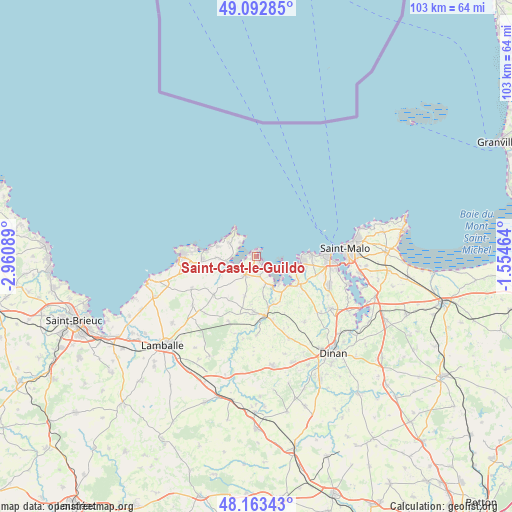
Saint-Cast-le-Guildo GPS coordinates[2]
48° 37' 49.008" North, 2° 15' 27.972" West
| Map corner | latitude | longitude |
|---|---|---|
| Upper-left | 49.09285°, | -2.96089° |
| Center: | 48.63028°, | -2.25777° |
| Lower-right: | 48.16343°, | -1.55464° |
| Map W x H: | 103.3×103.3 km | = 64.2×64.2mi |
| max Lat: | 51.07786° ⇑28.4% North |
| Saint-Cast-le-Guildo: | 48.63028° |
| min Lat: | ⇓71.6% South 41.3874° |
| min Long | Saint-Cast-le-G | max Long |
| -5.08615° | -2.25777° | 9.52242° |
| W 4.3%⇐ | ⇒95.7% E |
Elevation
Elevation of Saint-Cast-le-Guildo is 16 m = 52 ft, and this is 177.7 m = 583 ft below average elevation for this country.
| Max E: |
2333 m = 7654 ft | 95.4% |
| Avg. | 193.7 m = 635 ft | |
| Saint-Cast-le-Guildo | 16 m = 52 ft | |
Min E: |
-1 m = -3 ft | 4.6% |
See also: France elevation on elevation.city.
Geographical zone
Saint-Cast-le-Guildo is located in North temperate zone (between Tropic of Cancer and the Arctic Circle). Distance of this North polar circle is 1994 km =1239 mi to North.| Distance of | km | miles | from Saint-Cast-le-Guildo |
|---|---|---|---|
| North Pole | 4599.9 | 2858.2 | to North |
| Arctic Circle | 1994 | 1239 | to North |
| Tropic Cancer | 2801.3 | 1740.6 | to South |
| Equator | 5407.2 | 3359.9 | to South |


Nearby cities:
15 places around Saint-Cast-le-Guildo: (largest is in red/bold)
• Créhen
10 km =6.2 mi,  160°
160°
• Fréhel
8 km =5 mi,  272°
272°
• Hénanbihen
11.6 km =7.2 mi,  228°
228°
• Lancieux
8.3 km =5.2 mi,  107°
107°
• Matignon
4.5 km =2.8 mi,  213°
213°
• Ploubalay
10.2 km =6.3 mi,  122°
122°
• Pluduno
11.1 km =6.9 mi,  184°
184°
• Plurien
10.8 km =6.7 mi, 267°
• Pléboulle
6.4 km =4 mi,  247°
247°
• Ruca
9.2 km =5.7 mi,  220°
220°
• Saint-Briac-sur-Mer
9.1 km =5.7 mi,  95°
95°
• Saint-Jacut-de-la-Mer
6.2 km =3.9 mi,  125°
125°
• Saint-Lormel
9.5 km =5.9 mi,  167°
167°
• Saint-Lunaire
10.6 km =6.6 mi,  85°
85°
• Saint-Pôtan
9.1 km =5.7 mi,  191°
191°
Sources, notices
• [Note1] Compared only with cities in France existing in our database
• [Src1] Map data: © OpenStreetMap contributors (CC-BY-SA)
• [Src2] Other city data from geonames.org with taken over terms of usage.
• [Src3] Geographical zone / Annual Mean Temperature by Robert A. Rohde @ Wikipedia
