Lancieux geodata
Lancieux (Brittany) is a populated place; located in France in Europe/Paris (GMT+2) time zone. With population of 1,264 people, there are 7212 cities with bigger population in this country. Compared to other cities in France, 71.1% of cities are located further ↓South; 95.4% of cities are located further →East and 92.4% of cities have higher elevation than Lancieux. Note1
Administrative division(s):
- Level 1: Brittany
- Level 2: Département des Côtes-d’Armor
- Level 3: Arrondissement de Dinan
- Level 4: Lancieux


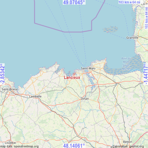
Lancieux GPS coordinates[2]
48° 36' 27.612" North, 2° 9' 1.08" West
| Map corner | latitude | longitude |
|---|---|---|
| Upper-left | 49.07045°, | -2.85342° |
| Center: | 48.60767°, | -2.1503° |
| Lower-right: | 48.14061°, | -1.44717° |
| Map W x H: | 103.4×103.4 km | = 64.2×64.2mi |
| max Lat: | 51.07786° ⇑28.9% North |
| Lancieux: | 48.60767° |
| min Lat: | ⇓71.1% South 41.3874° |
| min Long | Lancieux | max Long |
| -5.08615° | -2.1503° | 9.52242° |
| W 4.6%⇐ | ⇒95.4% E |
Elevation
Elevation of Lancieux is 24 m = 79 ft, and this is 169.7 m = 557 ft below average elevation for this country.
| Max E: |
2333 m = 7654 ft | 92.4% |
| Avg. | 193.7 m = 635 ft | |
| Lancieux | 24 m = 79 ft | |
Min E: |
-1 m = -3 ft | 7.6% |
See also: France elevation on elevation.city.
Geographical zone
Lancieux is located in North temperate zone (between Tropic of Cancer and the Arctic Circle). Distance of this North polar circle is 1996.5 km =1240.6 mi to North.| Distance of | km | miles | from Lancieux |
|---|---|---|---|
| North Pole | 4602.4 | 2859.8 | to North |
| Arctic Circle | 1996.5 | 1240.6 | to North |
| Tropic Cancer | 2798.7 | 1739 | to South |
| Equator | 5404.7 | 3358.3 | to South |


Nearby cities:
15 places around Lancieux: (largest is in red/bold)
• Créhen
8.3 km =5.2 mi,  213°
213°
• Dinard
7 km =4.3 mi,  67°
67°
• La Richardais
8.4 km =5.2 mi,  90°
90°
• Languenan
10.9 km =6.8 mi,  170°
170°
• Le Minihic-sur-Rance
10.9 km =6.8 mi,  107°
107°
• Matignon
10.4 km =6.5 mi,  263°
263°
• Pleslin-Trigavou
10.3 km =6.4 mi,  143°
143°
• Pleurtuit
7.5 km =4.7 mi,  115°
115°
• Ploubalay
3 km =1.9 mi, 166°
• Saint-Briac-sur-Mer
2 km =1.2 mi,  36°
36°
• Saint-Cast-le-Guildo
8.3 km =5.2 mi,  287°
287°
• Saint-Jacut-de-la-Mer
3.1 km =1.9 mi,  248°
248°
• Saint-Lormel
9 km =5.6 mi,  221°
221°
• Saint-Lunaire
4.3 km =2.7 mi, 38°
• Tréméreuc
8.4 km =5.2 mi,  130°
130°
Sources, notices
• [Note1] Compared only with cities in France existing in our database
• [Src1] Map data: © OpenStreetMap contributors (CC-BY-SA)
• [Src2] Other city data from geonames.org with taken over terms of usage.
• [Src3] Geographical zone / Annual Mean Temperature by Robert A. Rohde @ Wikipedia
