Coublevie geodata
Coublevie (Auvergne-Rhône-Alpes) is a populated place; located in France in Europe/Paris (GMT+2) time zone. With population of 3,992 people, there are 2464 cities with bigger population in this country. Compared to other cities in France, 75.7% of cities are located further ↑North; 83.8% of cities are located further ←West and 86.7% of cities have lower elevation than Coublevie. Note1
Administrative division(s):
- Level 1: Auvergne-Rhône-Alpes
- Level 2: Département de l'Isère
- Level 3: Arrondissement de Grenoble
- Level 4: Coublevie


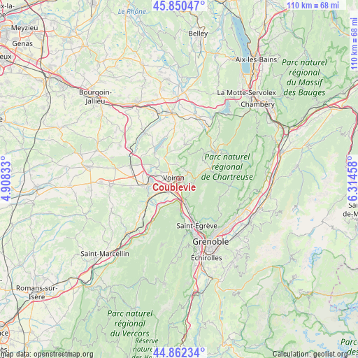
Coublevie GPS coordinates[2]
45° 21' 30.816" North, 5° 36' 41.256" East
| Map corner | latitude | longitude |
|---|---|---|
| Upper-left | 45.85047°, | 4.90833° |
| Center: | 45.35856°, | 5.61146° |
| Lower-right: | 44.86234°, | 6.31458° |
| Map W x H: | 109.9×109.9 km | = 68.3×68.3mi |
| max Lat: | 51.07786° ⇑75.7% North |
| Coublevie: | 45.35856° |
| min Lat: | ⇓24.3% South 41.3874° |
| min Long | Coublevie | max Long |
| -5.08615° | 5.61146° | 9.52242° |
| W 83.8%⇐ | ⇒16.2% E |
Elevation
Elevation of Coublevie is 370 m = 1214 ft, and this is 176.3 m = 578 ft above average elevation for this country.
| Max E: |
2333 m = 7654 ft | 13.3% |
| Coublevie | 370 m 1214 ft | |
| Avg. | 193.7 m = 635 ft | |
Min E: |
-1 m = -3 ft | 86.7% |
See also: France elevation on elevation.city.
Geographical zone
Coublevie is located in North temperate zone (between Tropic of Cancer and the Arctic Circle). Distance of this North polar circle is 2357.8 km =1465.1 mi to North.| Distance of | km | miles | from Coublevie |
|---|---|---|---|
| North Pole | 4963.7 | 3084.3 | to North |
| Arctic Circle | 2357.8 | 1465.1 | to North |
| Tropic Cancer | 2437.5 | 1514.6 | to South |
| Equator | 5043.4 | 3133.8 | to South |


Nearby cities:
15 places around Coublevie: (largest is in red/bold)
• Charnècles
6.7 km =4.2 mi,  256°
256°
• Chirens
7.2 km =4.5 mi,  323°
323°
• La Buisse
1.4 km =0.9 mi,  170°
170°
• La Murette
5.9 km =3.7 mi,  292°
292°
• Moirans
5.4 km =3.4 mi,  235°
235°
• Pommiers-la-Placette
5.7 km =3.5 mi,  141°
141°
• Réaumont
6.9 km =4.3 mi,  276°
276°
• Saint-Aupre
6.6 km =4.1 mi,  41°
41°
• Saint-Cassien
5 km =3.1 mi,  268°
268°
• Saint-Jean-de-Moirans
2.5 km =1.6 mi,  233°
233°
• Saint-Joseph-de-Rivière
6.9 km =4.3 mi,  73°
73°
• Saint-Nicolas-de-Macherin
5 km =3.1 mi,  351°
351°
• Saint-Étienne-de-Crossey
3.5 km =2.2 mi,  46°
46°
• Voiron
2.1 km =1.3 mi, 288°
• Voreppe
7.3 km =4.5 mi, 167°
Sources, notices
• [Note1] Compared only with cities in France existing in our database
• [Src1] Map data: © OpenStreetMap contributors (CC-BY-SA)
• [Src2] Other city data from geonames.org with taken over terms of usage.
• [Src3] Geographical zone / Annual Mean Temperature by Robert A. Rohde @ Wikipedia
