Rouilly-Saint-Loup geodata
Rouilly-Saint-Loup (Grand Est) is a populated place; located in France in Europe/Paris (GMT+2) time zone. With population of 558 people, there are 14045 cities with bigger population in this country. Compared to other cities in France, 63.9% of cities are located further ↓South; 69.3% of cities are located further ←West and 56.5% of cities have higher elevation than Rouilly-Saint-Loup. Note1
Administrative division(s):
- Level 1: Grand Est
- Level 2: Département de l'Aube
- Level 3: Arrondissement de Troyes
- Level 4: Rouilly-Saint-Loup


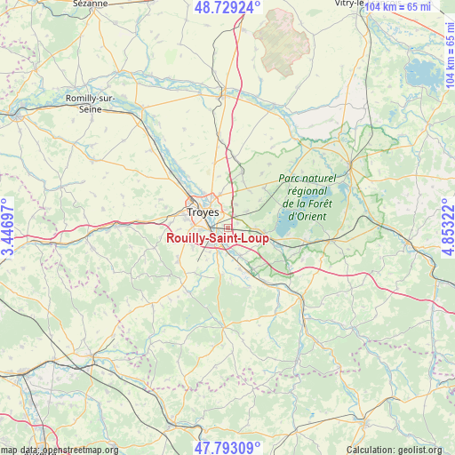
Rouilly-Saint-Loup GPS coordinates[2]
48° 15' 47.916" North, 4° 9' 0.324" East
| Map corner | latitude | longitude |
|---|---|---|
| Upper-left | 48.72924°, | 3.44697° |
| Center: | 48.26331°, | 4.15009° |
| Lower-right: | 47.79309°, | 4.85322° |
| Map W x H: | 104.1×104.1 km | = 64.7×64.7mi |
| max Lat: | 51.07786° ⇑36.1% North |
| Rouilly-Saint-Loup: | 48.26331° |
| min Lat: | ⇓63.9% South 41.3874° |
| min Long | Rouilly-Saint-L | max Long |
| -5.08615° | 4.15009° | 9.52242° |
| W 69.3%⇐ | ⇒30.7% E |
Elevation
Elevation of Rouilly-Saint-Loup is 112 m = 367 ft, and this is 81.7 m = 268 ft below average elevation for this country.
| Max E: |
2333 m = 7654 ft | 56.5% |
| Avg. | 193.7 m = 635 ft | |
| Rouilly-Saint-Loup | 112 m = 367 ft | |
Min E: |
-1 m = -3 ft | 43.5% |
See also: France elevation on elevation.city.
Geographical zone
Rouilly-Saint-Loup is located in North temperate zone (between Tropic of Cancer and the Arctic Circle). Distance of this North polar circle is 2034.8 km =1264.4 mi to North.| Distance of | km | miles | from Rouilly-Saint-Loup |
|---|---|---|---|
| North Pole | 4640.7 | 2883.6 | to North |
| Arctic Circle | 2034.8 | 1264.4 | to North |
| Tropic Cancer | 2760.5 | 1715.3 | to South |
| Equator | 5366.4 | 3334.5 | to South |


Nearby cities:
15 places around Rouilly-Saint-Loup: (largest is in red/bold)
• Bréviandes
4.1 km =2.5 mi,  260°
260°
• Buchères
4.2 km =2.6 mi,  221°
221°
• Clérey
6.7 km =4.2 mi,  152°
152°
• Creney-près-Troyes
7.9 km =4.9 mi,  350°
350°
• Isle-Aumont
5.9 km =3.7 mi,  197°
197°
• Montaulin
3.5 km =2.2 mi,  108°
108°
• Pont-Sainte-Marie
7.4 km =4.6 mi,  326°
326°
• Rosières-près-Troyes
5.6 km =3.5 mi,  268°
268°
• Saint-André-les-Vergers
7.7 km =4.8 mi,  288°
288°
• Saint-Julien-les-Villas
3.9 km =2.4 mi,  283°
283°
• Saint-Léger-près-Troyes
6.1 km =3.8 mi,  239°
239°
• Saint-Parres-aux-Tertres
4.5 km =2.8 mi, 327°
• Troyes
6.4 km =4 mi,  310°
310°
• Verrières
3.3 km =2.1 mi,  181°
181°
• Villechétif
5.4 km =3.4 mi, 354°
Sources, notices
• [Note1] Compared only with cities in France existing in our database
• [Src1] Map data: © OpenStreetMap contributors (CC-BY-SA)
• [Src2] Other city data from geonames.org with taken over terms of usage.
• [Src3] Geographical zone / Annual Mean Temperature by Robert A. Rohde @ Wikipedia
