Buchères geodata
Buchères (Grand Est) is a populated place; located in France in Europe/Paris (GMT+2) time zone. With population of 1,375 people, there are 6704 cities with bigger population in this country. Compared to other cities in France, 63.4% of cities are located further ↓South; 68.9% of cities are located further ←West and 56.5% of cities have higher elevation than Buchères. Note1
Administrative division(s):
- Level 1: Grand Est
- Level 2: Département de l'Aube
- Level 3: Arrondissement de Troyes
- Level 4: Buchères


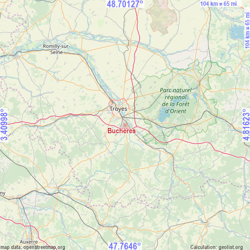
Buchères GPS coordinates[2]
48° 14' 6.288" North, 4° 6' 47.16" East
| Map corner | latitude | longitude |
|---|---|---|
| Upper-left | 48.70127°, | 3.40998° |
| Center: | 48.23508°, | 4.1131° |
| Lower-right: | 47.7646°, | 4.81623° |
| Map W x H: | 104.1×104.1 km | = 64.7×64.7mi |
| max Lat: | 51.07786° ⇑36.6% North |
| Buchères: | 48.23508° |
| min Lat: | ⇓63.4% South 41.3874° |
| min Long | Buchères | max Long |
| -5.08615° | 4.1131° | 9.52242° |
| W 68.9%⇐ | ⇒31.1% E |
Elevation
Elevation of Buchères is 112 m = 367 ft, and this is 81.7 m = 268 ft below average elevation for this country.
| Max E: |
2333 m = 7654 ft | 56.5% |
| Avg. | 193.7 m = 635 ft | |
| Buchères | 112 m = 367 ft | |
Min E: |
-1 m = -3 ft | 43.5% |
See also: France elevation on elevation.city.
Geographical zone
Buchères is located in North temperate zone (between Tropic of Cancer and the Arctic Circle). Distance of this North polar circle is 2037.9 km =1266.3 mi to North.| Distance of | km | miles | from Buchères |
|---|---|---|---|
| North Pole | 4643.8 | 2885.5 | to North |
| Arctic Circle | 2037.9 | 1266.3 | to North |
| Tropic Cancer | 2757.3 | 1713.3 | to South |
| Equator | 5363.2 | 3332.5 | to South |


Nearby cities:
15 places around Buchères: (largest is in red/bold)
• Bréviandes
2.8 km =1.7 mi,  331°
331°
• Clérey
6.5 km =4 mi,  115°
115°
• Isle-Aumont
2.7 km =1.7 mi,  159°
159°
• Montaulin
6.4 km =4 mi,  71°
71°
• Rosières-près-Troyes
4.2 km =2.6 mi,  315°
315°
• Rouilly-Saint-Loup
4.2 km =2.6 mi,  41°
41°
• Saint-André-les-Vergers
7.2 km =4.5 mi, 321°
• Saint-Germain
6.5 km =4 mi,  292°
292°
• Saint-Julien-les-Villas
4.2 km =2.6 mi,  345°
345°
• Saint-Léger-près-Troyes
2.5 km =1.6 mi,  271°
271°
• Saint-Parres-aux-Tertres
7 km =4.3 mi,  2°
2°
• Saint-Pouange
5.5 km =3.4 mi,  260°
260°
• Sainte-Savine
8.4 km =5.2 mi, 324°
• Troyes
7.6 km =4.7 mi,  344°
344°
• Verrières
2.7 km =1.7 mi,  94°
94°
Sources, notices
• [Note1] Compared only with cities in France existing in our database
• [Src1] Map data: © OpenStreetMap contributors (CC-BY-SA)
• [Src2] Other city data from geonames.org with taken over terms of usage.
• [Src3] Geographical zone / Annual Mean Temperature by Robert A. Rohde @ Wikipedia
