Roiffieux geodata
Roiffieux (Auvergne-Rhône-Alpes) is a populated place; located in France in Europe/Paris (GMT+2) time zone. With population of 2,599 people, there are 3752 cities with bigger population in this country. Compared to other cities in France, 77.1% of cities are located further ↑North; 73.3% of cities are located further ←West and 91% of cities have lower elevation than Roiffieux. Note1
Administrative division(s):
- Level 1: Auvergne-Rhône-Alpes
- Level 2: Département de l'Ardèche
- Level 3: Arrondissement de Tournon-sur-Rhône
- Level 4: Roiffieux


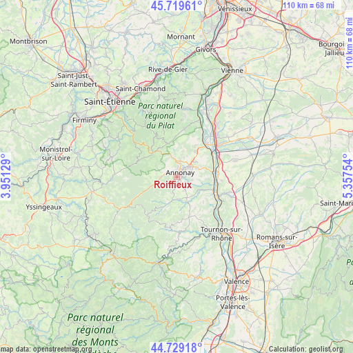
Roiffieux GPS coordinates[2]
45° 13' 35.58" North, 4° 39' 15.876" East
| Map corner | latitude | longitude |
|---|---|---|
| Upper-left | 45.71961°, | 3.95129° |
| Center: | 45.22655°, | 4.65441° |
| Lower-right: | 44.72918°, | 5.35754° |
| Map W x H: | 110.1×110.1 km | = 68.4×68.4mi |
| max Lat: | 51.07786° ⇑77.1% North |
| Roiffieux: | 45.22655° |
| min Lat: | ⇓22.9% South 41.3874° |
| min Long | Roiffieux | max Long |
| -5.08615° | 4.65441° | 9.52242° |
| W 73.3%⇐ | ⇒26.7% E |
Elevation
Elevation of Roiffieux is 449 m = 1473 ft, and this is 255.3 m = 838 ft above average elevation for this country.
| Max E: |
2333 m = 7654 ft | 9% |
| Roiffieux | 449 m 1473 ft | |
| Avg. | 193.7 m = 635 ft | |
Min E: |
-1 m = -3 ft | 91% |
See also: France elevation on elevation.city.
Geographical zone
Roiffieux is located in North temperate zone (between Tropic of Cancer and the Arctic Circle). Distance of this North polar circle is 2372.5 km =1474.2 mi to North.| Distance of | km | miles | from Roiffieux |
|---|---|---|---|
| North Pole | 4978.3 | 3093.4 | to North |
| Arctic Circle | 2372.5 | 1474.2 | to North |
| Tropic Cancer | 2422.8 | 1505.5 | to South |
| Equator | 5028.7 | 3124.7 | to South |


Nearby cities:
15 places around Roiffieux: (largest is in red/bold)
• Annonay
2 km =1.2 mi,  40°
40°
• Ardoix
7.8 km =4.8 mi,  124°
124°
• Boulieu-lès-Annonay
5 km =3.1 mi,  10°
10°
• Davézieux
5.2 km =3.2 mi,  52°
52°
• Peaugres
8.8 km =5.5 mi, 40°
• Quintenas
4.9 km =3 mi,  148°
148°
• Saint-Clair
6.1 km =3.8 mi,  19°
19°
• Saint-Cyr
6.6 km =4.1 mi,  64°
64°
• Saint-Marcel-lès-Annonay
7 km =4.3 mi,  341°
341°
• Satillieu
9 km =5.6 mi,  200°
200°
• Savas
8.3 km =5.2 mi, 20°
• Vanosc
8.1 km =5 mi,  268°
268°
• Vernosc-lès-Annonay
4.7 km =2.9 mi,  104°
104°
• Villevocance
5.2 km =3.2 mi, 267°
• Vocance
8.5 km =5.3 mi,  250°
250°
Sources, notices
• [Note1] Compared only with cities in France existing in our database
• [Src1] Map data: © OpenStreetMap contributors (CC-BY-SA)
• [Src2] Other city data from geonames.org with taken over terms of usage.
• [Src3] Geographical zone / Annual Mean Temperature by Robert A. Rohde @ Wikipedia
