Roderen geodata
Roderen (Grand Est) is a populated place; located in France in Europe/Paris (GMT+2) time zone. With population of 910 people, there are 9574 cities with bigger population in this country. Compared to other cities in France, 55.5% of cities are located further ↓South; 95.2% of cities are located further ←West and 86.6% of cities have lower elevation than Roderen. Note1
Administrative division(s):
- Level 1: Grand Est
- Level 2: Haut-Rhin
- Level 3: Arrondissement de Thann-Guebwiller
- Level 4: Roderen


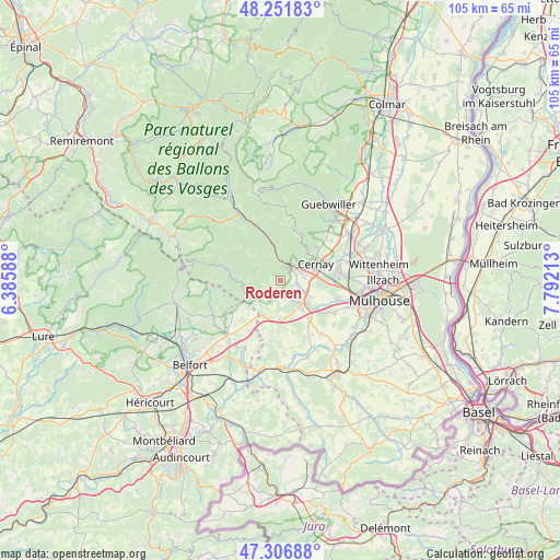
Roderen GPS coordinates[2]
47° 46' 53.4" North, 7° 5' 20.436" East
| Map corner | latitude | longitude |
|---|---|---|
| Upper-left | 48.25183°, | 6.38588° |
| Center: | 47.7815°, | 7.08901° |
| Lower-right: | 47.30688°, | 7.79213° |
| Map W x H: | 105.1×105.1 km | = 65.3×65.3mi |
| max Lat: | 51.07786° ⇑44.5% North |
| Roderen: | 47.7815° |
| min Lat: | ⇓55.5% South 41.3874° |
| min Long | Roderen | max Long |
| -5.08615° | 7.08901° | 9.52242° |
| W 95.2%⇐ | ⇒4.8% E |
Elevation
Elevation of Roderen is 368 m = 1207 ft, and this is 174.3 m = 572 ft above average elevation for this country.
| Max E: |
2333 m = 7654 ft | 13.4% |
| Roderen | 368 m 1207 ft | |
| Avg. | 193.7 m = 635 ft | |
Min E: |
-1 m = -3 ft | 86.6% |
See also: France elevation on elevation.city.
Geographical zone
Roderen is located in North temperate zone (between Tropic of Cancer and the Arctic Circle). Distance of this North polar circle is 2088.4 km =1297.7 mi to North.| Distance of | km | miles | from Roderen |
|---|---|---|---|
| North Pole | 4694.3 | 2916.9 | to North |
| Arctic Circle | 2088.4 | 1297.7 | to North |
| Tropic Cancer | 2706.9 | 1682 | to South |
| Equator | 5312.8 | 3301.2 | to South |


Nearby cities:
15 places around Roderen: (largest is in red/bold)
• Aspach-le-Bas
5.1 km =3.2 mi,  115°
115°
• Aspach-le-Haut
3.2 km =2 mi,  99°
99°
• Bitschwiller-lès-Thann
5.4 km =3.4 mi,  352°
352°
• Bourbach-le-Bas
2.4 km =1.5 mi,  251°
251°
• Burnhaupt-le-Haut
6.9 km =4.3 mi,  143°
143°
• Guewenheim
3.2 km =2 mi,  175°
175°
• Lauw
6 km =3.7 mi,  242°
242°
• Leimbach
1.6 km =1 mi,  32°
32°
• Masevaux
6.9 km =4.3 mi,  265°
265°
• Schweighouse-Thann
6.5 km =4 mi, 118°
• Sentheim
3.9 km =2.4 mi,  223°
223°
• Soppe-le-Haut
5.9 km =3.7 mi,  201°
201°
• Steinbach
6.5 km =4 mi,  47°
47°
• Thann
3.1 km =1.9 mi,  19°
19°
• Vieux-Thann
3.4 km =2.1 mi,  43°
43°
Sources, notices
• [Note1] Compared only with cities in France existing in our database
• [Src1] Map data: © OpenStreetMap contributors (CC-BY-SA)
• [Src2] Other city data from geonames.org with taken over terms of usage.
• [Src3] Geographical zone / Annual Mean Temperature by Robert A. Rohde @ Wikipedia
