Soppe-le-Haut geodata
Soppe-le-Haut (Grand Est) is a populated place; located in France in Europe/Paris (GMT+2) time zone. With population of 570 people, there are 13826 cities with bigger population in this country. Compared to other cities in France, 54.7% of cities are located further ↓South; 95.1% of cities are located further ←West and 84.8% of cities have lower elevation than Soppe-le-Haut. Note1
Administrative division(s):
- Level 1: Grand Est
- Level 2: Haut-Rhin
- Level 3: Arrondissement de Thann-Guebwiller
- Level 4: Le Haut Soultzbach


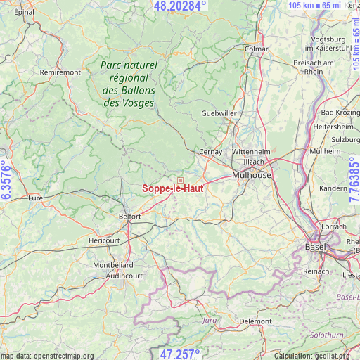
Soppe-le-Haut GPS coordinates[2]
47° 43' 55.452" North, 7° 3' 38.592" East
| Map corner | latitude | longitude |
|---|---|---|
| Upper-left | 48.20284°, | 6.3576° |
| Center: | 47.73207°, | 7.06072° |
| Lower-right: | 47.257°, | 7.76385° |
| Map W x H: | 105.2×105.2 km | = 65.4×65.4mi |
| max Lat: | 51.07786° ⇑45.3% North |
| Soppe-le-Haut: | 47.73207° |
| min Lat: | ⇓54.7% South 41.3874° |
| min Long | Soppe-le-Haut | max Long |
| -5.08615° | 7.06072° | 9.52242° |
| W 95.1%⇐ | ⇒4.9% E |
Elevation
Elevation of Soppe-le-Haut is 344 m = 1129 ft, and this is 150.3 m = 493 ft above average elevation for this country.
| Max E: |
2333 m = 7654 ft | 15.2% |
| Soppe-le-Haut | 344 m 1129 ft | |
| Avg. | 193.7 m = 635 ft | |
Min E: |
-1 m = -3 ft | 84.8% |
See also: France elevation on elevation.city.
Geographical zone
Soppe-le-Haut is located in North temperate zone (between Tropic of Cancer and the Arctic Circle). Distance of this North polar circle is 2093.9 km =1301.1 mi to North.| Distance of | km | miles | from Soppe-le-Haut |
|---|---|---|---|
| North Pole | 4699.8 | 2920.3 | to North |
| Arctic Circle | 2093.9 | 1301.1 | to North |
| Tropic Cancer | 2701.4 | 1678.6 | to South |
| Equator | 5307.3 | 3297.8 | to South |


Nearby cities:
15 places around Soppe-le-Haut: (largest is in red/bold)
• Aspach-le-Bas
7.5 km =4.7 mi,  64°
64°
• Aspach-le-Haut
7.2 km =4.5 mi,  46°
46°
• Bourbach-le-Bas
4.8 km =3 mi,  358°
358°
• Burnhaupt-le-Bas
7.7 km =4.8 mi,  102°
102°
• Burnhaupt-le-Haut
6.3 km =3.9 mi,  90°
90°
• Guewenheim
3.3 km =2.1 mi, 45°
• Lauw
4.2 km =2.6 mi,  310°
310°
• Leimbach
7.5 km =4.7 mi,  23°
23°
• Masevaux
6.9 km =4.3 mi,  316°
316°
• Roderen
5.9 km =3.7 mi, 21°
• Rougemont-le-Château
7 km =4.3 mi,  272°
272°
• Saint-Germain-le-Châtelet
8.6 km =5.3 mi,  243°
243°
• Schweighouse-Thann
8.2 km =5.1 mi,  73°
73°
• Sentheim
2.7 km =1.7 mi,  347°
347°
• Soppe-le-Bas
2.6 km =1.6 mi,  127°
127°
Sources, notices
• [Note1] Compared only with cities in France existing in our database
• [Src1] Map data: © OpenStreetMap contributors (CC-BY-SA)
• [Src2] Other city data from geonames.org with taken over terms of usage.
• [Src3] Geographical zone / Annual Mean Temperature by Robert A. Rohde @ Wikipedia
