Aspach-le-Haut geodata
Aspach-le-Haut (Grand Est) is a populated place; located in France in Europe/Paris (GMT+2) time zone. With population of 1,180 people, there are 7645 cities with bigger population in this country. Compared to other cities in France, 55.4% of cities are located further ↓South; 95.4% of cities are located further ←West and 82.1% of cities have lower elevation than Aspach-le-Haut. Note1
Administrative division(s):
- Level 1: Grand Est
- Level 2: Haut-Rhin
- Level 3: Arrondissement de Thann-Guebwiller
- Level 4: Aspach-Michelbach


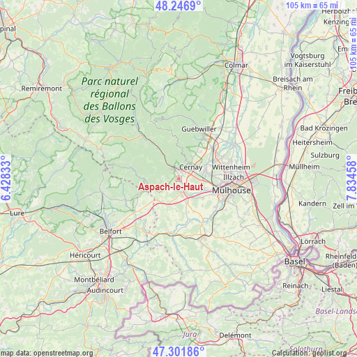
Aspach-le-Haut GPS coordinates[2]
47° 46' 35.508" North, 7° 7' 53.22" East
| Map corner | latitude | longitude |
|---|---|---|
| Upper-left | 48.2469°, | 6.42833° |
| Center: | 47.77653°, | 7.13145° |
| Lower-right: | 47.30186°, | 7.83458° |
| Map W x H: | 105.1×105.1 km | = 65.3×65.3mi |
| max Lat: | 51.07786° ⇑44.6% North |
| Aspach-le-Haut: | 47.77653° |
| min Lat: | ⇓55.4% South 41.3874° |
| min Long | Aspach-le-Haut | max Long |
| -5.08615° | 7.13145° | 9.52242° |
| W 95.4%⇐ | ⇒4.6% E |
Elevation
Elevation of Aspach-le-Haut is 311 m = 1020 ft, and this is 117.3 m = 385 ft above average elevation for this country.
| Max E: |
2333 m = 7654 ft | 17.9% |
| Aspach-le-Haut | 311 m 1020 ft | |
| Avg. | 193.7 m = 635 ft | |
Min E: |
-1 m = -3 ft | 82.1% |
See also: France elevation on elevation.city.
Geographical zone
Aspach-le-Haut is located in North temperate zone (between Tropic of Cancer and the Arctic Circle). Distance of this North polar circle is 2088.9 km =1298 mi to North.| Distance of | km | miles | from Aspach-le-Haut |
|---|---|---|---|
| North Pole | 4694.8 | 2917.2 | to North |
| Arctic Circle | 2088.9 | 1298 | to North |
| Tropic Cancer | 2706.3 | 1681.6 | to South |
| Equator | 5312.3 | 3300.9 | to South |


Nearby cities:
15 places around Aspach-le-Haut: (largest is in red/bold)
• Aspach-le-Bas
2.2 km =1.4 mi,  139°
139°
• Bitschwiller-lès-Thann
7.1 km =4.4 mi,  326°
326°
• Bourbach-le-Bas
5.4 km =3.4 mi,  267°
267°
• Burnhaupt-le-Bas
6.9 km =4.3 mi,  161°
161°
• Burnhaupt-le-Haut
5.1 km =3.2 mi,  169°
169°
• Cernay
5 km =3.1 mi,  42°
42°
• Guewenheim
3.9 km =2.4 mi,  227°
227°
• Leimbach
3 km =1.9 mi,  309°
309°
• Roderen
3.2 km =2 mi,  279°
279°
• Schweighouse-Thann
3.7 km =2.3 mi, 135°
• Sentheim
6.3 km =3.9 mi,  248°
248°
• Steinbach
5.2 km =3.2 mi,  17°
17°
• Thann
4.1 km =2.5 mi, 328°
• Uffholtz
6 km =3.7 mi, 35°
• Vieux-Thann
3.2 km =2 mi,  345°
345°
Sources, notices
• [Note1] Compared only with cities in France existing in our database
• [Src1] Map data: © OpenStreetMap contributors (CC-BY-SA)
• [Src2] Other city data from geonames.org with taken over terms of usage.
• [Src3] Geographical zone / Annual Mean Temperature by Robert A. Rohde @ Wikipedia
