Remungol geodata
Remungol (Brittany) is a populated place; located in France in Europe/Paris (GMT+2) time zone. With population of 931 people, there are 9375 cities with bigger population in this country. Compared to other cities in France, 58.1% of cities are located further ↓South; 97.1% of cities are located further →East and 62% of cities have higher elevation than Remungol. Note1
Administrative division(s):
- Level 1: Brittany
- Level 2: Morbihan
- Level 3: Arrondissement de Pontivy
- Level 4: Évellys


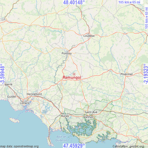
Remungol GPS coordinates[2]
47° 55' 57.108" North, 2° 53' 46.86" West
| Map corner | latitude | longitude |
|---|---|---|
| Upper-left | 48.40148°, | -3.59948° |
| Center: | 47.93253°, | -2.89635° |
| Lower-right: | 47.45929°, | -2.19323° |
| Map W x H: | 104.8×104.8 km | = 65.1×65.1mi |
| max Lat: | 51.07786° ⇑41.9% North |
| Remungol: | 47.93253° |
| min Lat: | ⇓58.1% South 41.3874° |
| min Long | Remungol | max Long |
| -5.08615° | -2.89635° | 9.52242° |
| W 2.9%⇐ | ⇒97.1% E |
Elevation
Elevation of Remungol is 97 m = 318 ft, and this is 96.7 m = 317 ft below average elevation for this country.
| Max E: |
2333 m = 7654 ft | 62% |
| Avg. | 193.7 m = 635 ft | |
| Remungol | 97 m = 318 ft | |
Min E: |
-1 m = -3 ft | 38% |
See also: France elevation on elevation.city.
Geographical zone
Remungol is located in North temperate zone (between Tropic of Cancer and the Arctic Circle). Distance of this North polar circle is 2071.6 km =1287.2 mi to North.| Distance of | km | miles | from Remungol |
|---|---|---|---|
| North Pole | 4677.5 | 2906.5 | to North |
| Arctic Circle | 2071.6 | 1287.2 | to North |
| Tropic Cancer | 2723.7 | 1692.4 | to South |
| Equator | 5329.6 | 3311.7 | to South |


Nearby cities:
15 places around Remungol: (largest is in red/bold)
• Baud
11.1 km =6.9 mi,  234°
234°
• Bignan
11 km =6.8 mi,  122°
122°
• Camors
12.2 km =7.6 mi,  219°
219°
• Guénin
6.8 km =4.2 mi,  245°
245°
• La Chapelle-Neuve
8.3 km =5.2 mi,  203°
203°
• Locminé
6.9 km =4.3 mi,  138°
138°
• Moréac
5.9 km =3.7 mi,  103°
103°
• Moustoir-Ac
9.8 km =6.1 mi,  152°
152°
• Moustoir-Remungol
7.2 km =4.5 mi,  356°
356°
• Naizin
7.9 km =4.9 mi,  36°
36°
• Plumelin
8.1 km =5 mi,  175°
175°
• Pluméliau
6.5 km =4 mi,  295°
295°
• Réguiny
12.3 km =7.6 mi,  66°
66°
• Saint-Allouestre
2 km =1.2 mi, 151°
• Saint-Thuriau
10.2 km =6.3 mi,  336°
336°
Sources, notices
• [Note1] Compared only with cities in France existing in our database
• [Src1] Map data: © OpenStreetMap contributors (CC-BY-SA)
• [Src2] Other city data from geonames.org with taken over terms of usage.
• [Src3] Geographical zone / Annual Mean Temperature by Robert A. Rohde @ Wikipedia
