Remouillé geodata
Remouillé (Pays de la Loire) is a populated place; located in France in Europe/Paris (GMT+2) time zone. With population of 1,558 people, there are 5980 cities with bigger population in this country. Compared to other cities in France, 54.7% of cities are located further ↑North; 91.3% of cities are located further →East and 87.4% of cities have higher elevation than Remouillé. Note1
Administrative division(s):
- Level 1: Pays de la Loire
- Level 2: Loire-Atlantique
- Level 3: Arrondissement de Nantes
- Level 4: Remouillé


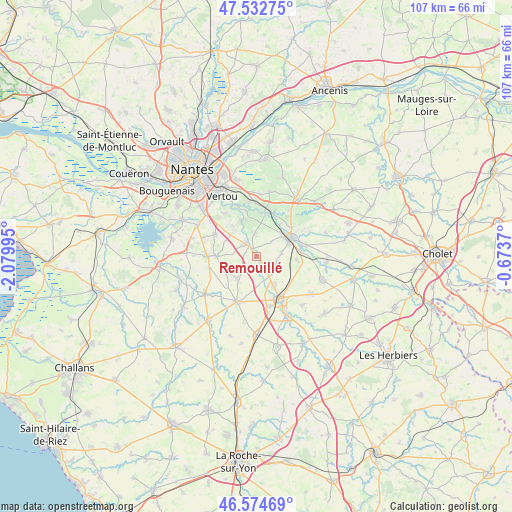
Remouillé GPS coordinates[2]
47° 3' 21.132" North, 1° 22' 36.552" West
| Map corner | latitude | longitude |
|---|---|---|
| Upper-left | 47.53275°, | -2.07995° |
| Center: | 47.05587°, | -1.37682° |
| Lower-right: | 46.57469°, | -0.6737° |
| Map W x H: | 106.5×106.5 km | = 66.2×66.2mi |
| max Lat: | 51.07786° ⇑54.7% North |
| Remouillé: | 47.05587° |
| min Lat: | ⇓45.3% South 41.3874° |
| min Long | Remouillé | max Long |
| -5.08615° | -1.37682° | 9.52242° |
| W 8.7%⇐ | ⇒91.3% E |
Elevation
Elevation of Remouillé is 36 m = 118 ft, and this is 157.7 m = 517 ft below average elevation for this country.
| Max E: |
2333 m = 7654 ft | 87.4% |
| Avg. | 193.7 m = 635 ft | |
| Remouillé | 36 m = 118 ft | |
Min E: |
-1 m = -3 ft | 12.6% |
See also: France elevation on elevation.city.
Geographical zone
Remouillé is located in North temperate zone (between Tropic of Cancer and the Arctic Circle). Distance of this North polar circle is 2169.1 km =1347.8 mi to North.| Distance of | km | miles | from Remouillé |
|---|---|---|---|
| North Pole | 4774.9 | 2967 | to North |
| Arctic Circle | 2169.1 | 1347.8 | to North |
| Tropic Cancer | 2626.2 | 1631.8 | to South |
| Equator | 5232.1 | 3251.1 | to South |


Nearby cities:
15 places around Remouillé: (largest is in red/bold)
• Aigrefeuille-sur-Maine
3.2 km =2 mi,  322°
322°
• Clisson
7.9 km =4.9 mi,  63°
63°
• Cugand
9.4 km =5.8 mi,  85°
85°
• Gorges
7.5 km =4.7 mi,  50°
50°
• Gétigné
10 km =6.2 mi,  76°
76°
• La Bernardière
8.4 km =5.2 mi, 94°
• La Planche
6.1 km =3.8 mi,  223°
223°
• Le Bignon
9.8 km =6.1 mi,  297°
297°
• Le Pallet
9.7 km =6 mi,  19°
19°
• Maisdon-sur-Sèvre
4.6 km =2.9 mi,  356°
356°
• Monnières
8.8 km =5.5 mi,  11°
11°
• Montbert
8.5 km =5.3 mi,  270°
270°
• Saint-Hilaire-de-Clisson
5.3 km =3.3 mi, 82°
• Saint-Hilaire-de-Loulay
6.9 km =4.3 mi,  149°
149°
• Saint-Lumine-de-Clisson
4.4 km =2.7 mi, 45°
Sources, notices
• [Note1] Compared only with cities in France existing in our database
• [Src1] Map data: © OpenStreetMap contributors (CC-BY-SA)
• [Src2] Other city data from geonames.org with taken over terms of usage.
• [Src3] Geographical zone / Annual Mean Temperature by Robert A. Rohde @ Wikipedia
