Quillan geodata
Quillan (Occitanie) is a populated place; located in France in Europe/Paris (GMT+2) time zone. With population of 3,893 people, there are 2522 cities with bigger population in this country. Compared to other cities in France, 98.7% of cities are located further ↑North; 54.7% of cities are located further →East and 80.1% of cities have lower elevation than Quillan. Note1
Administrative division(s):
- Level 1: Occitanie
- Level 2: Département de l'Aude
- Level 3: Arrondissement de Limoux
- Level 4: Quillan


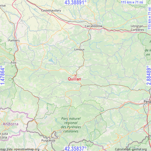
Quillan GPS coordinates[2]
42° 52' 32.844" North, 2° 10' 54.336" East
| Map corner | latitude | longitude |
|---|---|---|
| Upper-left | 43.38891°, | 1.47864° |
| Center: | 42.87579°, | 2.18176° |
| Lower-right: | 42.35837°, | 2.88489° |
| Map W x H: | 114.6×114.6 km | = 71.2×71.2mi |
| max Lat: | 51.07786° ⇑98.7% North |
| Quillan: | 42.87579° |
| min Lat: | ⇓1.3% South 41.3874° |
| min Long | Quillan | max Long |
| -5.08615° | 2.18176° | 9.52242° |
| W 45.3%⇐ | ⇒54.7% E |
Elevation
Elevation of Quillan is 291 m = 955 ft, and this is 97.3 m = 319 ft above average elevation for this country.
| Max E: |
2333 m = 7654 ft | 19.9% |
| Quillan | 291 m 955 ft | |
| Avg. | 193.7 m = 635 ft | |
Min E: |
-1 m = -3 ft | 80.1% |
See also: France elevation on elevation.city.
Geographical zone
Quillan is located in North temperate zone (between Tropic of Cancer and the Arctic Circle). Distance of this Northern Tropic circle is 2161.4 km =1343 mi to South.| Distance of | km | miles | from Quillan |
|---|---|---|---|
| North Pole | 5239.7 | 3255.8 | to North |
| Arctic Circle | 2633.8 | 1636.6 | to North |
| Tropic Cancer | 2161.4 | 1343 | to South |
| Equator | 4767.3 | 2962.3 | to South |


Nearby cities:
15 places around Quillan: (largest is in red/bold)
• Alet-les-Bains
14.5 km =9 mi,  24°
24°
• Axat
9.1 km =5.7 mi,  152°
152°
• Bélesta
20.5 km =12.7 mi,  278°
278°
• Campagne-sur-Aude
4.9 km =3 mi, 24°
• Caudiès-de-Fenouillèdes
17.3 km =10.7 mi,  114°
114°
• Chalabre
18.6 km =11.6 mi,  309°
309°
• Couiza
9.4 km =5.8 mi,  38°
38°
• Cournanel
18 km =11.2 mi,  13°
13°
• Espéraza
7 km =4.3 mi,  26°
26°
• Fougax-et-Barrineuf
23.4 km =14.5 mi,  271°
271°
• La Bastide-sur-l’Hers
23.9 km =14.9 mi,  291°
291°
• Limoux
20.2 km =12.6 mi, 9°
• Léran
25.4 km =15.8 mi,  299°
299°
• Montazels
9.1 km =5.7 mi, 34°
• Pieusse
23.1 km =14.4 mi, 10°
Sources, notices
• [Note1] Compared only with cities in France existing in our database
• [Src1] Map data: © OpenStreetMap contributors (CC-BY-SA)
• [Src2] Other city data from geonames.org with taken over terms of usage.
• [Src3] Geographical zone / Annual Mean Temperature by Robert A. Rohde @ Wikipedia
