Pieusse geodata
Pieusse (Occitanie) is a populated place; located in France in Europe/Paris (GMT+2) time zone. With population of 984 people, there are 8953 cities with bigger population in this country. Compared to other cities in France, 98.1% of cities are located further ↑North; 53.9% of cities are located further →East and 62.7% of cities have lower elevation than Pieusse. Note1
Administrative division(s):
- Level 1: Occitanie
- Level 2: Département de l'Aude
- Level 3: Arrondissement de Limoux
- Level 4: Pieusse


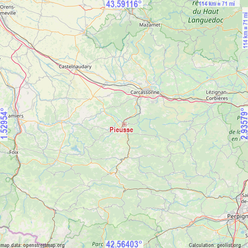
Pieusse GPS coordinates[2]
43° 4' 47.1" North, 2° 13' 57.576" East
| Map corner | latitude | longitude |
|---|---|---|
| Upper-left | 43.59116°, | 1.52954° |
| Center: | 43.07975°, | 2.23266° |
| Lower-right: | 42.56403°, | 2.93579° |
| Map W x H: | 114.2×114.2 km | = 71×71mi |
| max Lat: | 51.07786° ⇑98.1% North |
| Pieusse: | 43.07975° |
| min Lat: | ⇓1.9% South 41.3874° |
| min Long | Pieusse | max Long |
| -5.08615° | 2.23266° | 9.52242° |
| W 46.1%⇐ | ⇒53.9% E |
Elevation
Elevation of Pieusse is 183 m = 600 ft, and this is 10.7 m = 35 ft below average elevation for this country.
| Max E: |
2333 m = 7654 ft | 37.3% |
| Avg. | 193.7 m = 635 ft | |
| Pieusse | 183 m = 600 ft | |
Min E: |
-1 m = -3 ft | 62.7% |
See also: France elevation on elevation.city.
Geographical zone
Pieusse is located in North temperate zone (between Tropic of Cancer and the Arctic Circle). Distance of this Northern Tropic circle is 2184.1 km =1357.1 mi to South.| Distance of | km | miles | from Pieusse |
|---|---|---|---|
| North Pole | 5217 | 3241.7 | to North |
| Arctic Circle | 2611.2 | 1622.5 | to North |
| Tropic Cancer | 2184.1 | 1357.1 | to South |
| Equator | 4790 | 2976.4 | to South |


Nearby cities:
15 places around Pieusse: (largest is in red/bold)
• Alairac
11.7 km =7.3 mi,  3°
3°
• Alet-les-Bains
9.7 km =6 mi,  168°
168°
• Arzens
13.3 km =8.3 mi,  351°
351°
• Belvèze-du-Razès
12.3 km =7.6 mi,  294°
294°
• Cavanac
12.5 km =7.8 mi,  38°
38°
• Couffoulens
10.3 km =6.4 mi, 35°
• Cournanel
5.2 km =3.2 mi,  178°
178°
• Cépie
3 km =1.9 mi,  20°
20°
• Lavalette
12 km =7.5 mi,  13°
13°
• Leuc
10.5 km =6.5 mi, 44°
• Limoux
2.9 km =1.8 mi,  197°
197°
• Montazels
15.1 km =9.4 mi, 176°
• Montréal
15.3 km =9.5 mi,  330°
330°
• Pomas
6.1 km =3.8 mi,  53°
53°
• Saint-Hilaire
6.5 km =4 mi,  77°
77°
Sources, notices
• [Note1] Compared only with cities in France existing in our database
• [Src1] Map data: © OpenStreetMap contributors (CC-BY-SA)
• [Src2] Other city data from geonames.org with taken over terms of usage.
• [Src3] Geographical zone / Annual Mean Temperature by Robert A. Rohde @ Wikipedia
