Cournanel geodata
Cournanel (Occitanie) is a populated place; located in France in Europe/Paris (GMT+2) time zone. With population of 571 people, there are 13815 cities with bigger population in this country. Compared to other cities in France, 98.2% of cities are located further ↑North; 53.8% of cities are located further →East and 65.6% of cities have lower elevation than Cournanel. Note1
Administrative division(s):
- Level 1: Occitanie
- Level 2: Département de l'Aude
- Level 3: Arrondissement de Limoux
- Level 4: Cournanel


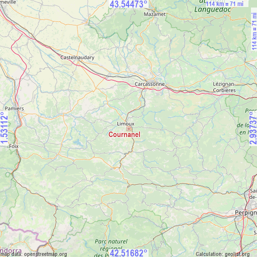
Cournanel GPS coordinates[2]
43° 1' 58.548" North, 2° 14' 3.264" East
| Map corner | latitude | longitude |
|---|---|---|
| Upper-left | 43.54473°, | 1.53112° |
| Center: | 43.03293°, | 2.23424° |
| Lower-right: | 42.51682°, | 2.93737° |
| Map W x H: | 114.3×114.3 km | = 71×71mi |
| max Lat: | 51.07786° ⇑98.2% North |
| Cournanel: | 43.03293° |
| min Lat: | ⇓1.8% South 41.3874° |
| min Long | Cournanel | max Long |
| -5.08615° | 2.23424° | 9.52242° |
| W 46.2%⇐ | ⇒53.8% E |
Elevation
Elevation of Cournanel is 197 m = 646 ft, and this is 3.3 m = 11 ft above average elevation for this country.
| Max E: |
2333 m = 7654 ft | 34.4% |
| Cournanel | 197 m 646 ft | |
| Avg. | 193.7 m = 635 ft | |
Min E: |
-1 m = -3 ft | 65.6% |
See also: France elevation on elevation.city.
Geographical zone
Cournanel is located in North temperate zone (between Tropic of Cancer and the Arctic Circle). Distance of this Northern Tropic circle is 2178.9 km =1353.9 mi to South.| Distance of | km | miles | from Cournanel |
|---|---|---|---|
| North Pole | 5222.2 | 3244.9 | to North |
| Arctic Circle | 2616.4 | 1625.8 | to North |
| Tropic Cancer | 2178.9 | 1353.9 | to South |
| Equator | 4784.8 | 2973.1 | to South |


Nearby cities:
15 places around Cournanel: (largest is in red/bold)
• Alairac
16.9 km =10.5 mi,  1°
1°
• Alet-les-Bains
4.6 km =2.9 mi,  157°
157°
• Belvèze-du-Razès
15.3 km =9.5 mi,  312°
312°
• Campagne-sur-Aude
13.2 km =8.2 mi,  189°
189°
• Cavanac
16.8 km =10.4 mi,  26°
26°
• Couffoulens
14.8 km =9.2 mi,  23°
23°
• Couiza
10.2 km =6.3 mi,  170°
170°
• Cépie
8.1 km =5 mi,  6°
6°
• Espéraza
11.3 km =7 mi, 185°
• Leuc
14.6 km =9.1 mi, 29°
• Limoux
2.6 km =1.6 mi,  337°
337°
• Montazels
9.9 km =6.2 mi,  175°
175°
• Pieusse
5.2 km =3.2 mi,  358°
358°
• Pomas
10 km =6.2 mi, 28°
• Saint-Hilaire
9.1 km =5.7 mi,  43°
43°
Sources, notices
• [Note1] Compared only with cities in France existing in our database
• [Src1] Map data: © OpenStreetMap contributors (CC-BY-SA)
• [Src2] Other city data from geonames.org with taken over terms of usage.
• [Src3] Geographical zone / Annual Mean Temperature by Robert A. Rohde @ Wikipedia
