Quibou geodata
Quibou (Normandy) is a populated place; located in France in Europe/Paris (GMT+2) time zone. With population of 825 people, there are 10340 cities with bigger population in this country. Compared to other cities in France, 81.2% of cities are located further ↓South; 90% of cities are located further →East and 78.2% of cities have higher elevation than Quibou. Note1
Administrative division(s):
- Level 1: Normandy
- Level 2: Manche
- Level 3: Arrondissement de Saint-Lô
- Level 4: Quibou


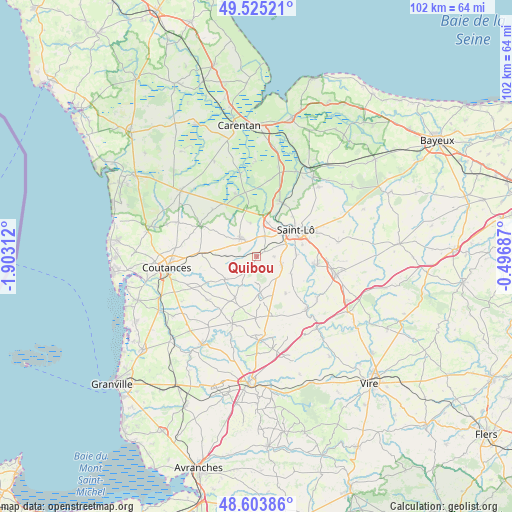
Quibou GPS coordinates[2]
49° 4' 0.012" North, 1° 12' 0" West
| Map corner | latitude | longitude |
|---|---|---|
| Upper-left | 49.52521°, | -1.90312° |
| Center: | 49.06667°, | -1.2° |
| Lower-right: | 48.60386°, | -0.49687° |
| Map W x H: | 102.4×102.4 km | = 63.6×63.6mi |
| max Lat: | 51.07786° ⇑18.8% North |
| Quibou: | 49.06667° |
| min Lat: | ⇓81.2% South 41.3874° |
| min Long | Quibou | max Long |
| -5.08615° | -1.2° | 9.52242° |
| W 10%⇐ | ⇒90% E |
Elevation
Elevation of Quibou is 59 m = 194 ft, and this is 134.7 m = 442 ft below average elevation for this country.
| Max E: |
2333 m = 7654 ft | 78.2% |
| Avg. | 193.7 m = 635 ft | |
| Quibou | 59 m = 194 ft | |
Min E: |
-1 m = -3 ft | 21.8% |
See also: France elevation on elevation.city.
Geographical zone
Quibou is located in North temperate zone (between Tropic of Cancer and the Arctic Circle). Distance of this North polar circle is 1945.5 km =1208.9 mi to North.| Distance of | km | miles | from Quibou |
|---|---|---|---|
| North Pole | 4551.4 | 2828.1 | to North |
| Arctic Circle | 1945.5 | 1208.9 | to North |
| Tropic Cancer | 2849.8 | 1770.8 | to South |
| Equator | 5455.7 | 3390 | to South |


Nearby cities:
15 places around Quibou: (largest is in red/bold)
• Agneaux
9 km =5.6 mi,  49°
49°
• Canisy
2 km =1.2 mi,  60°
60°
• Carantilly
3 km =1.9 mi,  267°
267°
• Cerisy-la-Salle
7.5 km =4.7 mi,  233°
233°
• Dangy
3 km =1.9 mi,  215°
215°
• Hébécrevon
7.2 km =4.5 mi,  20°
20°
• La Chapelle-en-Juger
6.9 km =4.3 mi,  350°
350°
• Le Lorey
8.4 km =5.2 mi,  290°
290°
• Marigny
4.8 km =3 mi,  320°
320°
• Notre-Dame-de-Cenilly
9 km =5.6 mi,  208°
208°
• Saint-Gilles
4.5 km =2.8 mi, 21°
• Saint-Martin-de-Bonfossé
2.7 km =1.7 mi,  125°
125°
• Saint-Romphaire
7.6 km =4.7 mi,  114°
114°
• Saint-Samson-de-Bonfossé
5.5 km =3.4 mi, 110°
• Saint-Ébremond-de-Bonfossé
3.6 km =2.2 mi,  88°
88°
Sources, notices
• [Note1] Compared only with cities in France existing in our database
• [Src1] Map data: © OpenStreetMap contributors (CC-BY-SA)
• [Src2] Other city data from geonames.org with taken over terms of usage.
• [Src3] Geographical zone / Annual Mean Temperature by Robert A. Rohde @ Wikipedia
