Pontpierre geodata
Pontpierre (Grand Est) is a populated place; located in France in Europe/Paris (GMT+2) time zone. With population of 808 people, there are 10506 cities with bigger population in this country. Compared to other cities in France, 80.7% of cities are located further ↓South; 92.6% of cities are located further ←West and 75.4% of cities have lower elevation than Pontpierre. Note1
Administrative division(s):
- Level 1: Grand Est
- Level 2: Moselle
- Level 3: Arrondissement de Forbach-Boulay-Moselle
- Level 4: Pontpierre


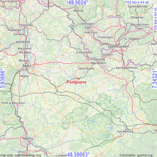
Pontpierre GPS coordinates[2]
49° 2' 37.14" North, 6° 38' 24.288" East
| Map corner | latitude | longitude |
|---|---|---|
| Upper-left | 49.5024°, | 5.93696° |
| Center: | 49.04365°, | 6.64008° |
| Lower-right: | 48.58063°, | 7.34321° |
| Map W x H: | 102.5×102.5 km | = 63.7×63.7mi |
| max Lat: | 51.07786° ⇑19.3% North |
| Pontpierre: | 49.04365° |
| min Lat: | ⇓80.7% South 41.3874° |
| min Long | Pontpierre | max Long |
| -5.08615° | 6.64008° | 9.52242° |
| W 92.6%⇐ | ⇒7.4% E |
Elevation
Elevation of Pontpierre is 252 m = 827 ft, and this is 58.3 m = 191 ft above average elevation for this country.
| Max E: |
2333 m = 7654 ft | 24.6% |
| Pontpierre | 252 m 827 ft | |
| Avg. | 193.7 m = 635 ft | |
Min E: |
-1 m = -3 ft | 75.4% |
See also: France elevation on elevation.city.
Geographical zone
Pontpierre is located in North temperate zone (between Tropic of Cancer and the Arctic Circle). Distance of this North polar circle is 1948 km =1210.4 mi to North.| Distance of | km | miles | from Pontpierre |
|---|---|---|---|
| North Pole | 4553.9 | 2829.7 | to North |
| Arctic Circle | 1948 | 1210.4 | to North |
| Tropic Cancer | 2847.2 | 1769.2 | to South |
| Equator | 5453.1 | 3388.4 | to South |


Nearby cities:
15 places around Pontpierre: (largest is in red/bold)
• Altviller
7.5 km =4.7 mi,  63°
63°
• Bambiderstroff
7.5 km =4.7 mi,  332°
332°
• Créhange
4.6 km =2.9 mi,  291°
291°
• Faulquemont
3.2 km =2 mi,  281°
281°
• Flétrange
6 km =3.7 mi, 291°
• Folschviller
4.9 km =3 mi,  40°
40°
• Guessling-Hémering
2.5 km =1.6 mi,  146°
146°
• Lachambre
8.7 km =5.4 mi, 61°
• Lixing-lès-Saint-Avold
8.2 km =5.1 mi,  95°
95°
• Longeville-lès-Saint-Avold
8.1 km =5 mi,  1°
1°
• Saint-Avold
8.2 km =5.1 mi,  34°
34°
• Teting-sur-Nied
2.2 km =1.4 mi,  48°
48°
• Vahl-Ebersing
8.2 km =5.1 mi,  85°
85°
• Valmont
6.2 km =3.9 mi, 42°
• Zimming
9.7 km =6 mi,  337°
337°
Sources, notices
• [Note1] Compared only with cities in France existing in our database
• [Src1] Map data: © OpenStreetMap contributors (CC-BY-SA)
• [Src2] Other city data from geonames.org with taken over terms of usage.
• [Src3] Geographical zone / Annual Mean Temperature by Robert A. Rohde @ Wikipedia
