Podensac geodata
Podensac (Nouvelle-Aquitaine) is a populated place; located in France in Europe/Paris (GMT+2) time zone. With population of 2,595 people, there are 3761 cities with bigger population in this country. Compared to other cities in France, 82.4% of cities are located further ↑North; 81.5% of cities are located further →East and 95.4% of cities have higher elevation than Podensac. Note1
Administrative division(s):
- Level 1: Nouvelle-Aquitaine
- Level 2: Gironde
- Level 3: Arrondissement de Langon
- Level 4: Podensac


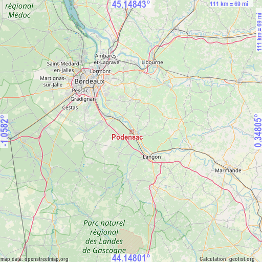
Podensac GPS coordinates[2]
44° 39' 1.368" North, 0° 21' 18.288" West
| Map corner | latitude | longitude |
|---|---|---|
| Upper-left | 45.14843°, | -1.0582° |
| Center: | 44.65038°, | -0.35508° |
| Lower-right: | 44.14801°, | 0.34805° |
| Map W x H: | 111.2×111.2 km | = 69.1×69.1mi |
| max Lat: | 51.07786° ⇑82.4% North |
| Podensac: | 44.65038° |
| min Lat: | ⇓17.6% South 41.3874° |
| min Long | Podensac | max Long |
| -5.08615° | -0.35508° | 9.52242° |
| W 18.5%⇐ | ⇒81.5% E |
Elevation
Elevation of Podensac is 16 m = 52 ft, and this is 177.7 m = 583 ft below average elevation for this country.
| Max E: |
2333 m = 7654 ft | 95.4% |
| Avg. | 193.7 m = 635 ft | |
| Podensac | 16 m = 52 ft | |
Min E: |
-1 m = -3 ft | 4.6% |
See also: France elevation on elevation.city.
Geographical zone
Podensac is located in North temperate zone (between Tropic of Cancer and the Arctic Circle). Distance of this Northern Tropic circle is 2358.7 km =1465.6 mi to South.| Distance of | km | miles | from Podensac |
|---|---|---|---|
| North Pole | 5042.4 | 3133.2 | to North |
| Arctic Circle | 2436.5 | 1514 | to North |
| Tropic Cancer | 2358.7 | 1465.6 | to South |
| Equator | 4964.7 | 3084.9 | to South |


Nearby cities:
15 places around Podensac: (largest is in red/bold)
• Arbanats
4.2 km =2.6 mi,  312°
312°
• Barsac
5.7 km =3.5 mi,  146°
146°
• Béguey
2.7 km =1.7 mi,  108°
108°
• Cadillac
3.4 km =2.1 mi,  117°
117°
• Capian
7 km =4.3 mi,  16°
16°
• Cérons
2.4 km =1.5 mi,  133°
133°
• Illats
6.1 km =3.8 mi,  193°
193°
• Langoiran
7.2 km =4.5 mi,  334°
334°
• Lestiac-sur-Garonne
5.1 km =3.2 mi,  342°
342°
• Loupiac
5.7 km =3.5 mi, 130°
• Paillet
3.9 km =2.4 mi,  348°
348°
• Portets
7.5 km =4.7 mi, 313°
• Rions
1.5 km =0.9 mi,  11°
11°
• Saint-Michel-de-Rieufret
7 km =4.3 mi,  243°
243°
• Virelade
2.6 km =1.6 mi, 311°
Sources, notices
• [Note1] Compared only with cities in France existing in our database
• [Src1] Map data: © OpenStreetMap contributors (CC-BY-SA)
• [Src2] Other city data from geonames.org with taken over terms of usage.
• [Src3] Geographical zone / Annual Mean Temperature by Robert A. Rohde @ Wikipedia
