Plouvara geodata
Plouvara (Brittany) is a populated place; located in France in Europe/Paris (GMT+2) time zone. With population of 961 people, there are 9120 cities with bigger population in this country. Compared to other cities in France, 68.5% of cities are located further ↓South; 97.1% of cities are located further →East and 59.8% of cities have lower elevation than Plouvara. Note1
Administrative division(s):
- Level 1: Brittany
- Level 2: Département des Côtes-d’Armor
- Level 3: Arrondissement de Guingamp
- Level 4: Plouvara


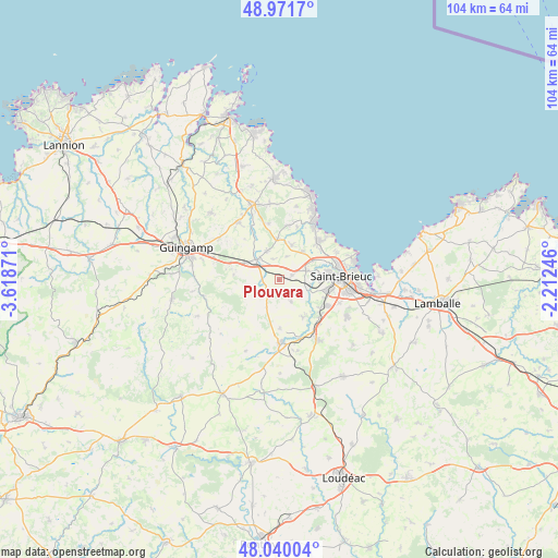
Plouvara GPS coordinates[2]
48° 30' 28.836" North, 2° 54' 56.088" West
| Map corner | latitude | longitude |
|---|---|---|
| Upper-left | 48.9717°, | -3.61871° |
| Center: | 48.50801°, | -2.91558° |
| Lower-right: | 48.04004°, | -2.21246° |
| Map W x H: | 103.6×103.6 km | = 64.4×64.4mi |
| max Lat: | 51.07786° ⇑31.5% North |
| Plouvara: | 48.50801° |
| min Lat: | ⇓68.5% South 41.3874° |
| min Long | Plouvara | max Long |
| -5.08615° | -2.91558° | 9.52242° |
| W 2.9%⇐ | ⇒97.1% E |
Elevation
Elevation of Plouvara is 169 m = 554 ft, and this is 24.7 m = 81 ft below average elevation for this country.
| Max E: |
2333 m = 7654 ft | 40.2% |
| Avg. | 193.7 m = 635 ft | |
| Plouvara | 169 m = 554 ft | |
Min E: |
-1 m = -3 ft | 59.8% |
See also: France elevation on elevation.city.
Geographical zone
Plouvara is located in North temperate zone (between Tropic of Cancer and the Arctic Circle). Distance of this North polar circle is 2007.6 km =1247.5 mi to North.| Distance of | km | miles | from Plouvara |
|---|---|---|---|
| North Pole | 4613.5 | 2866.7 | to North |
| Arctic Circle | 2007.6 | 1247.5 | to North |
| Tropic Cancer | 2787.7 | 1732.2 | to South |
| Equator | 5393.6 | 3351.4 | to South |


Nearby cities:
15 places around Plouvara: (largest is in red/bold)
• Boqueho
4.3 km =2.7 mi,  230°
230°
• Châtelaudren
5.5 km =3.4 mi,  310°
310°
• La Méaugon
5.8 km =3.6 mi,  99°
99°
• Lanrodec
8.6 km =5.3 mi,  276°
276°
• Le Fœil
8.3 km =5.2 mi,  180°
180°
• Plaine-Haute
8.4 km =5.2 mi,  147°
147°
• Plerneuf
2.6 km =1.6 mi,  72°
72°
• Plouagat
6.9 km =4.3 mi,  296°
296°
• Ploufragan
9.1 km =5.7 mi, 101°
• Plélo
5.7 km =3.5 mi,  336°
336°
• Pordic
10 km =6.2 mi,  46°
46°
• Saint-Donan
4.9 km =3 mi, 151°
• Saint-Julien
9.9 km =6.2 mi,  129°
129°
• Trégomeur
6.9 km =4.3 mi,  20°
20°
• Trémuson
5.2 km =3.2 mi, 71°
Sources, notices
• [Note1] Compared only with cities in France existing in our database
• [Src1] Map data: © OpenStreetMap contributors (CC-BY-SA)
• [Src2] Other city data from geonames.org with taken over terms of usage.
• [Src3] Geographical zone / Annual Mean Temperature by Robert A. Rohde @ Wikipedia
