Pordic geodata
Pordic (Brittany) is a populated place; located in France in Europe/Paris (GMT+2) time zone. With population of 5,441 people, there are 1812 cities with bigger population in this country. Compared to other cities in France, 70.1% of cities are located further ↓South; 96.9% of cities are located further →East and 59.7% of cities have higher elevation than Pordic. Note1
Administrative division(s):
- Level 1: Brittany
- Level 2: Département des Côtes-d’Armor
- Level 3: Arrondissement de Saint-Brieuc
- Level 4: Pordic


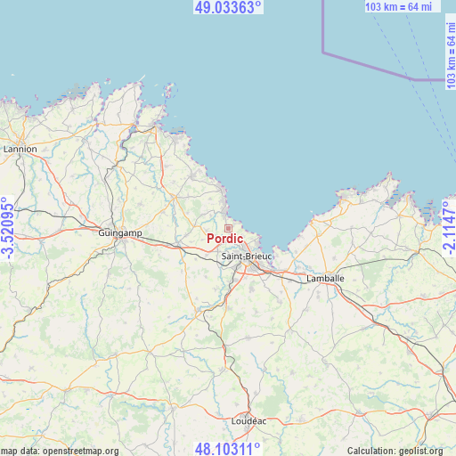
Pordic GPS coordinates[2]
48° 34' 13.836" North, 2° 49' 4.188" West
| Map corner | latitude | longitude |
|---|---|---|
| Upper-left | 49.03363°, | -3.52095° |
| Center: | 48.57051°, | -2.81783° |
| Lower-right: | 48.10311°, | -2.1147° |
| Map W x H: | 103.5×103.5 km | = 64.3×64.3mi |
| max Lat: | 51.07786° ⇑29.9% North |
| Pordic: | 48.57051° |
| min Lat: | ⇓70.1% South 41.3874° |
| min Long | Pordic | max Long |
| -5.08615° | -2.81783° | 9.52242° |
| W 3.1%⇐ | ⇒96.9% E |
Elevation
Elevation of Pordic is 103 m = 338 ft, and this is 90.7 m = 298 ft below average elevation for this country.
| Max E: |
2333 m = 7654 ft | 59.7% |
| Avg. | 193.7 m = 635 ft | |
| Pordic | 103 m = 338 ft | |
Min E: |
-1 m = -3 ft | 40.3% |
See also: France elevation on elevation.city.
Geographical zone
Pordic is located in North temperate zone (between Tropic of Cancer and the Arctic Circle). Distance of this North polar circle is 2000.6 km =1243.1 mi to North.| Distance of | km | miles | from Pordic |
|---|---|---|---|
| North Pole | 4606.5 | 2862.3 | to North |
| Arctic Circle | 2000.6 | 1243.1 | to North |
| Tropic Cancer | 2794.6 | 1736.5 | to South |
| Equator | 5400.5 | 3355.7 | to South |


Nearby cities:
15 places around Pordic: (largest is in red/bold)
• Binic
3.4 km =2.1 mi,  349°
349°
• La Méaugon
8.1 km =5 mi,  190°
190°
• Langueux
11.1 km =6.9 mi,  138°
138°
• Lantic
6.2 km =3.9 mi,  310°
310°
• Plerneuf
7.8 km =4.8 mi,  217°
217°
• Ploufragan
9 km =5.6 mi,  168°
168°
• Plouvara
10 km =6.2 mi,  226°
226°
• Plélo
9.6 km =6 mi,  259°
259°
• Plérin
4.2 km =2.6 mi, 138°
• Saint-Brieuc
7.2 km =4.5 mi,  149°
149°
• Saint-Quay-Portrieux
8.9 km =5.5 mi, 353°
• Trégomeur
4.8 km =3 mi, 264°
• Tréguidel
9.8 km =6.1 mi,  290°
290°
• Trémuson
5.7 km =3.5 mi,  203°
203°
• Étables-sur-Mer
7.1 km =4.4 mi, 350°
Sources, notices
• [Note1] Compared only with cities in France existing in our database
• [Src1] Map data: © OpenStreetMap contributors (CC-BY-SA)
• [Src2] Other city data from geonames.org with taken over terms of usage.
• [Src3] Geographical zone / Annual Mean Temperature by Robert A. Rohde @ Wikipedia
