Plougourvest geodata
Plougourvest (Brittany) is a populated place; located in France in Europe/Paris (GMT+2) time zone. With population of 1,207 people, there are 7490 cities with bigger population in this country. Compared to other cities in France, 69.5% of cities are located further ↓South; 99.1% of cities are located further →East and 56.5% of cities have higher elevation than Plougourvest. Note1
Administrative division(s):
- Level 1: Brittany
- Level 2: Département du Finistère
- Level 3: Arrondissement de Morlaix
- Level 4: Plougourvest


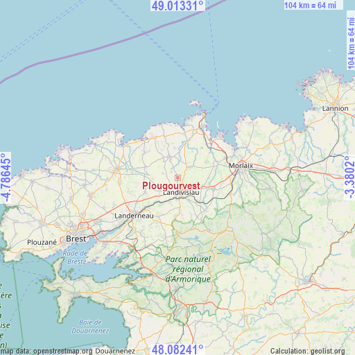
Plougourvest GPS coordinates[2]
48° 33' 0" North, 4° 4' 59.988" West
| Map corner | latitude | longitude |
|---|---|---|
| Upper-left | 49.01331°, | -4.78645° |
| Center: | 48.55°, | -4.08333° |
| Lower-right: | 48.08241°, | -3.3802° |
| Map W x H: | 103.5×103.5 km | = 64.3×64.3mi |
| max Lat: | 51.07786° ⇑30.5% North |
| Plougourvest: | 48.55° |
| min Lat: | ⇓69.5% South 41.3874° |
| min Long | Plougourvest | max Long |
| -5.08615° | -4.08333° | 9.52242° |
| W 0.9%⇐ | ⇒99.1% E |
Elevation
Elevation of Plougourvest is 112 m = 367 ft, and this is 81.7 m = 268 ft below average elevation for this country.
| Max E: |
2333 m = 7654 ft | 56.5% |
| Avg. | 193.7 m = 635 ft | |
| Plougourvest | 112 m = 367 ft | |
Min E: |
-1 m = -3 ft | 43.5% |
See also: France elevation on elevation.city.
Geographical zone
Plougourvest is located in North temperate zone (between Tropic of Cancer and the Arctic Circle). Distance of this North polar circle is 2002.9 km =1244.5 mi to North.| Distance of | km | miles | from Plougourvest |
|---|---|---|---|
| North Pole | 4608.8 | 2863.8 | to North |
| Arctic Circle | 2002.9 | 1244.5 | to North |
| Tropic Cancer | 2792.3 | 1735.1 | to South |
| Equator | 5398.3 | 3354.3 | to South |


Nearby cities:
15 places around Plougourvest: (largest is in red/bold)
• Bodilis
3.3 km =2.1 mi,  226°
226°
• Guiclan
8.9 km =5.5 mi,  90°
90°
• Guimiliau
9.4 km =5.8 mi,  137°
137°
• Lampaul-Guimiliau
7.2 km =4.5 mi,  154°
154°
• Landivisiau
4.8 km =3 mi,  166°
166°
• Lanhouarneau
9.8 km =6.1 mi,  289°
289°
• Mespaul
8.8 km =5.5 mi,  29°
29°
• Plougar
5.2 km =3.2 mi, 290°
• Plounéventer
10.5 km =6.5 mi,  249°
249°
• Plouvorn
5.2 km =3.2 mi,  44°
44°
• Plouzévédé
6.1 km =3.8 mi,  336°
336°
• Saint-Derrien
7.4 km =4.6 mi,  270°
270°
• Saint-Servais
6.2 km =3.9 mi, 232°
• Saint-Thégonnec
10.5 km =6.5 mi,  110°
110°
• Saint-Vougay
6.7 km =4.2 mi,  326°
326°
Sources, notices
• [Note1] Compared only with cities in France existing in our database
• [Src1] Map data: © OpenStreetMap contributors (CC-BY-SA)
• [Src2] Other city data from geonames.org with taken over terms of usage.
• [Src3] Geographical zone / Annual Mean Temperature by Robert A. Rohde @ Wikipedia
