Plounéventer geodata
Plounéventer (Brittany) is a populated place; located in France in Europe/Paris (GMT+2) time zone. With population of 1,567 people, there are 5948 cities with bigger population in this country. Compared to other cities in France, 68.7% of cities are located further ↓South; 99.4% of cities are located further →East and 60.8% of cities have higher elevation than Plounéventer. Note1
Administrative division(s):
- Level 1: Brittany
- Level 2: Département du Finistère
- Level 3: Arrondissement de Morlaix
- Level 4: Plounéventer


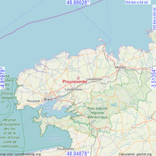
Plounéventer GPS coordinates[2]
48° 31' 0.012" North, 4° 13' 0.012" West
| Map corner | latitude | longitude |
|---|---|---|
| Upper-left | 48.98028°, | -4.91979° |
| Center: | 48.51667°, | -4.21667° |
| Lower-right: | 48.04878°, | -3.51354° |
| Map W x H: | 103.6×103.6 km | = 64.4×64.4mi |
| max Lat: | 51.07786° ⇑31.3% North |
| Plounéventer: | 48.51667° |
| min Lat: | ⇓68.7% South 41.3874° |
| min Long | Plounéventer | max Long |
| -5.08615° | -4.21667° | 9.52242° |
| W 0.6%⇐ | ⇒99.4% E |
Elevation
Elevation of Plounéventer is 100 m = 328 ft, and this is 93.7 m = 307 ft below average elevation for this country.
| Max E: |
2333 m = 7654 ft | 60.8% |
| Avg. | 193.7 m = 635 ft | |
| Plounéventer | 100 m = 328 ft | |
Min E: |
-1 m = -3 ft | 39.2% |
See also: France elevation on elevation.city.
Geographical zone
Plounéventer is located in North temperate zone (between Tropic of Cancer and the Arctic Circle). Distance of this North polar circle is 2006.6 km =1246.8 mi to North.| Distance of | km | miles | from Plounéventer |
|---|---|---|---|
| North Pole | 4612.5 | 2866.1 | to North |
| Arctic Circle | 2006.6 | 1246.8 | to North |
| Tropic Cancer | 2788.6 | 1732.8 | to South |
| Equator | 5394.5 | 3352 | to South |


Nearby cities:
15 places around Plounéventer: (largest is in red/bold)
• Bodilis
7.6 km =4.7 mi,  78°
78°
• La Martyre
8.7 km =5.4 mi,  150°
150°
• La Roche-Maurice
4.8 km =3 mi,  167°
167°
• Landerneau
7.6 km =4.7 mi,  200°
200°
• Lanhouarneau
7 km =4.3 mi,  4°
4°
• Le Folgoët
10.2 km =6.3 mi,  300°
300°
• Lesneven
9.9 km =6.2 mi,  308°
308°
• Pencran
9.3 km =5.8 mi,  187°
187°
• Ploudaniel
7.6 km =4.7 mi,  284°
284°
• Ploudiry
8.9 km =5.5 mi, 146°
• Plougar
7.4 km =4.6 mi,  41°
41°
• Plouédern
4.4 km =2.7 mi,  213°
213°
• Saint-Derrien
4.4 km =2.7 mi,  33°
33°
• Saint-Servais
4.9 km =3 mi,  90°
90°
• Saint-Thonan
9.4 km =5.8 mi,  246°
246°
Sources, notices
• [Note1] Compared only with cities in France existing in our database
• [Src1] Map data: © OpenStreetMap contributors (CC-BY-SA)
• [Src2] Other city data from geonames.org with taken over terms of usage.
• [Src3] Geographical zone / Annual Mean Temperature by Robert A. Rohde @ Wikipedia
