Lanhouarneau geodata
Lanhouarneau (Brittany) is a populated place; located in France in Europe/Paris (GMT+2) time zone. With population of 963 people, there are 9104 cities with bigger population in this country. Compared to other cities in France, 70.3% of cities are located further ↓South; 99.3% of cities are located further →East and 64.4% of cities have higher elevation than Lanhouarneau. Note1
Administrative division(s):
- Level 1: Brittany
- Level 2: Département du Finistère
- Level 3: Arrondissement de Morlaix
- Level 4: Lanhouarneau


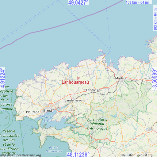
Lanhouarneau GPS coordinates[2]
48° 34' 46.812" North, 4° 12' 32.796" West
| Map corner | latitude | longitude |
|---|---|---|
| Upper-left | 49.0427°, | -4.91224° |
| Center: | 48.57967°, | -4.20911° |
| Lower-right: | 48.11236°, | -3.50599° |
| Map W x H: | 103.4×103.4 km | = 64.2×64.2mi |
| max Lat: | 51.07786° ⇑29.7% North |
| Lanhouarneau: | 48.57967° |
| min Lat: | ⇓70.3% South 41.3874° |
| min Long | Lanhouarneau | max Long |
| -5.08615° | -4.20911° | 9.52242° |
| W 0.7%⇐ | ⇒99.3% E |
Elevation
Elevation of Lanhouarneau is 91 m = 299 ft, and this is 102.7 m = 337 ft below average elevation for this country.
| Max E: |
2333 m = 7654 ft | 64.4% |
| Avg. | 193.7 m = 635 ft | |
| Lanhouarneau | 91 m = 299 ft | |
Min E: |
-1 m = -3 ft | 35.6% |
See also: France elevation on elevation.city.
Geographical zone
Lanhouarneau is located in North temperate zone (between Tropic of Cancer and the Arctic Circle). Distance of this North polar circle is 1999.6 km =1242.5 mi to North.| Distance of | km | miles | from Lanhouarneau |
|---|---|---|---|
| North Pole | 4605.5 | 2861.7 | to North |
| Arctic Circle | 1999.6 | 1242.5 | to North |
| Tropic Cancer | 2795.6 | 1737.1 | to South |
| Equator | 5401.6 | 3356.4 | to South |


Nearby cities:
15 places around Lanhouarneau: (largest is in red/bold)
• Bodilis
8.8 km =5.5 mi,  128°
128°
• Le Folgoët
9.5 km =5.9 mi,  259°
259°
• Lesneven
8.3 km =5.2 mi, 264°
• Ploudaniel
9.4 km =5.8 mi,  236°
236°
• Plouescat
10.2 km =6.3 mi,  17°
17°
• Plougar
4.6 km =2.9 mi,  108°
108°
• Plougourvest
9.8 km =6.1 mi, 109°
• Plouider
7.8 km =4.8 mi,  301°
301°
• Plounéventer
7 km =4.3 mi,  184°
184°
• Plounévez-Lochrist
4.2 km =2.6 mi,  352°
352°
• Plouzévédé
7.2 km =4.5 mi,  71°
71°
• Saint-Derrien
3.8 km =2.4 mi,  150°
150°
• Saint-Servais
8.2 km =5.1 mi, 148°
• Saint-Vougay
6 km =3.7 mi, 67°
• Tréflez
5.9 km =3.7 mi,  314°
314°
Sources, notices
• [Note1] Compared only with cities in France existing in our database
• [Src1] Map data: © OpenStreetMap contributors (CC-BY-SA)
• [Src2] Other city data from geonames.org with taken over terms of usage.
• [Src3] Geographical zone / Annual Mean Temperature by Robert A. Rohde @ Wikipedia
