Ploudaniel geodata
Ploudaniel (Brittany) is a populated place; located in France in Europe/Paris (GMT+2) time zone. With population of 3,910 people, there are 2515 cities with bigger population in this country. Compared to other cities in France, 69.1% of cities are located further ↓South; 99.6% of cities are located further →East and 75% of cities have higher elevation than Ploudaniel. Note1
Administrative division(s):
- Level 1: Brittany
- Level 2: Département du Finistère
- Level 3: Arrondissement de Brest
- Level 4: Ploudaniel


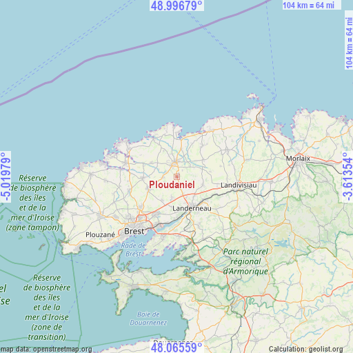
Ploudaniel GPS coordinates[2]
48° 31' 59.988" North, 4° 19' 0.012" West
| Map corner | latitude | longitude |
|---|---|---|
| Upper-left | 48.99679°, | -5.01979° |
| Center: | 48.53333°, | -4.31667° |
| Lower-right: | 48.06559°, | -3.61354° |
| Map W x H: | 103.5×103.5 km | = 64.3×64.3mi |
| max Lat: | 51.07786° ⇑30.9% North |
| Ploudaniel: | 48.53333° |
| min Lat: | ⇓69.1% South 41.3874° |
| min Long | Ploudaniel | max Long |
| -5.08615° | -4.31667° | 9.52242° |
| W 0.4%⇐ | ⇒99.6% E |
Elevation
Elevation of Ploudaniel is 67 m = 220 ft, and this is 126.7 m = 416 ft below average elevation for this country.
| Max E: |
2333 m = 7654 ft | 75% |
| Avg. | 193.7 m = 635 ft | |
| Ploudaniel | 67 m = 220 ft | |
Min E: |
-1 m = -3 ft | 25% |
See also: France elevation on elevation.city.
Geographical zone
Ploudaniel is located in North temperate zone (between Tropic of Cancer and the Arctic Circle). Distance of this North polar circle is 2004.8 km =1245.7 mi to North.| Distance of | km | miles | from Ploudaniel |
|---|---|---|---|
| North Pole | 4610.7 | 2865 | to North |
| Arctic Circle | 2004.8 | 1245.7 | to North |
| Tropic Cancer | 2790.5 | 1733.9 | to South |
| Equator | 5396.4 | 3353.2 | to South |


Nearby cities:
15 places around Ploudaniel: (largest is in red/bold)
• Kernilis
8.5 km =5.3 mi,  299°
299°
• Kernouës
6.6 km =4.1 mi,  339°
339°
• Kersaint-Plabennec
8 km =5 mi,  210°
210°
• Lanhouarneau
9.4 km =5.8 mi,  56°
56°
• Le Drennec
3.9 km =2.4 mi,  272°
272°
• Le Folgoët
3.7 km =2.3 mi, 336°
• Lesneven
4.3 km =2.7 mi,  355°
355°
• Plabennec
8.8 km =5.5 mi,  247°
247°
• Plouider
9.3 km =5.8 mi,  7°
7°
• Plounéventer
7.6 km =4.7 mi,  104°
104°
• Plouvien
9.8 km =6.1 mi, 270°
• Plouédern
7.4 km =4.6 mi,  138°
138°
• Saint-Frégant
8.9 km =5.5 mi,  326°
326°
• Saint-Thonan
5.7 km =3.5 mi,  192°
192°
• Tréflez
10 km =6.2 mi,  21°
21°
Sources, notices
• [Note1] Compared only with cities in France existing in our database
• [Src1] Map data: © OpenStreetMap contributors (CC-BY-SA)
• [Src2] Other city data from geonames.org with taken over terms of usage.
• [Src3] Geographical zone / Annual Mean Temperature by Robert A. Rohde @ Wikipedia
