Pleyber-Christ geodata
Pleyber-Christ (Brittany) is a populated place; located in France in Europe/Paris (GMT+2) time zone. With population of 2,903 people, there are 3353 cities with bigger population in this country. Compared to other cities in France, 68.3% of cities are located further ↓South; 98.8% of cities are located further →East and 53.8% of cities have higher elevation than Pleyber-Christ. Note1
Administrative division(s):
- Level 1: Brittany
- Level 2: Département du Finistère
- Level 3: Arrondissement de Morlaix
- Level 4: Pleyber-Christ


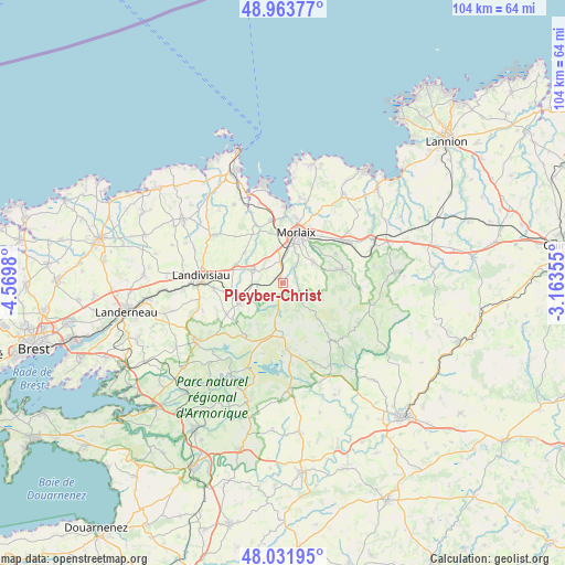
Pleyber-Christ GPS coordinates[2]
48° 30' 0" North, 3° 52' 0.012" West
| Map corner | latitude | longitude |
|---|---|---|
| Upper-left | 48.96377°, | -4.5698° |
| Center: | 48.5°, | -3.86667° |
| Lower-right: | 48.03195°, | -3.16355° |
| Map W x H: | 103.6×103.6 km | = 64.4×64.4mi |
| max Lat: | 51.07786° ⇑31.7% North |
| Pleyber-Christ: | 48.5° |
| min Lat: | ⇓68.3% South 41.3874° |
| min Long | Pleyber-Christ | max Long |
| -5.08615° | -3.86667° | 9.52242° |
| W 1.2%⇐ | ⇒98.8% E |
Elevation
Elevation of Pleyber-Christ is 120 m = 394 ft, and this is 73.7 m = 242 ft below average elevation for this country.
| Max E: |
2333 m = 7654 ft | 53.8% |
| Avg. | 193.7 m = 635 ft | |
| Pleyber-Christ | 120 m = 394 ft | |
Min E: |
-1 m = -3 ft | 46.2% |
See also: France elevation on elevation.city.
Geographical zone
Pleyber-Christ is located in North temperate zone (between Tropic of Cancer and the Arctic Circle). Distance of this North polar circle is 2008.5 km =1248 mi to North.| Distance of | km | miles | from Pleyber-Christ |
|---|---|---|---|
| North Pole | 4614.4 | 2867.3 | to North |
| Arctic Circle | 2008.5 | 1248 | to North |
| Tropic Cancer | 2786.8 | 1731.6 | to South |
| Equator | 5392.7 | 3350.9 | to South |


Nearby cities:
15 places around Pleyber-Christ: (largest is in red/bold)
• Commana
11.7 km =7.3 mi,  214°
214°
• Guiclan
8.9 km =5.5 mi,  308°
308°
• Guimiliau
9.7 km =6 mi,  262°
262°
• La Feuillée
12.1 km =7.5 mi,  175°
175°
• Lampaul-Guimiliau
12.9 km =8 mi,  265°
265°
• Le Cloître-Saint-Thégonnec
5.8 km =3.6 mi,  112°
112°
• Morlaix
9.1 km =5.7 mi,  18°
18°
• Plougonven
11.2 km =7 mi,  80°
80°
• Plounéour-Ménez
5.7 km =3.5 mi,  192°
192°
• Plourin-lès-Morlaix
7.2 km =4.5 mi,  58°
58°
• Saint-Martin-des-Champs
9.6 km =6 mi,  14°
14°
• Saint-Sauveur
11.3 km =7 mi,  240°
240°
• Saint-Thégonnec
6.4 km =4 mi,  286°
286°
• Sainte-Sève
7.4 km =4.6 mi,  0°
0°
• Taulé
11.4 km =7.1 mi,  347°
347°
Sources, notices
• [Note1] Compared only with cities in France existing in our database
• [Src1] Map data: © OpenStreetMap contributors (CC-BY-SA)
• [Src2] Other city data from geonames.org with taken over terms of usage.
• [Src3] Geographical zone / Annual Mean Temperature by Robert A. Rohde @ Wikipedia
