Le Cloître-Saint-Thégonnec geodata
Le Cloître-Saint-Thégonnec (Brittany) is a populated place; located in France in Europe/Paris (GMT+2) time zone. With population of 599 people, there are 13333 cities with bigger population in this country. Compared to other cities in France, 67.9% of cities are located further ↓South; 98.7% of cities are located further →East and 70.1% of cities have lower elevation than Le Cloître-Saint-Thégonnec. Note1
Administrative division(s):
- Level 1: Brittany
- Level 2: Département du Finistère
- Level 3: Arrondissement de Morlaix
- Level 4: Le Cloître-Saint-Thégonnec
Current local time in Le Cloître-Saint-Thégonnec:
04:46 PM, SaturdayDifference from your time zone: hours


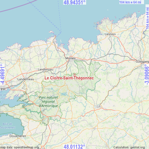
Le Cloître-Saint-Thégonnec GPS coordinates[2]
48° 28' 46.416" North, 3° 47' 37.608" West
| Map corner | latitude | longitude |
|---|---|---|
| Upper-left | 48.94351°, | -4.49691° |
| Center: | 48.47956°, | -3.79378° |
| Lower-right: | 48.01132°, | -3.09066° |
| Map W x H: | 103.6×103.6 km | = 64.4×64.4mi |
| max Lat: | 51.07786° ⇑32.1% North |
| Le Cloître-Saint-Thégonnec: | 48.47956° |
| min Lat: | ⇓67.9% South 41.3874° |
| min Long | Le Cloître-Sai | max Long |
| -5.08615° | -3.79378° | 9.52242° |
| W 1.3%⇐ | ⇒98.7% E |
Elevation
Elevation of Le Cloître-Saint-Thégonnec is 220 m = 722 ft, and this is 26.3 m = 86 ft above average elevation for this country.
| Max E: |
2333 m = 7654 ft | 29.9% |
| Le Cloître-Saint-Thégonnec | 220 m 722 ft | |
| Avg. | 193.7 m = 635 ft | |
Min E: |
-1 m = -3 ft | 70.1% |
See also: France elevation on elevation.city.
Geographical zone
Le Cloître-Saint-Thégonnec is located in North temperate zone (between Tropic of Cancer and the Arctic Circle). Distance of this North polar circle is 2010.8 km =1249.5 mi to North.| Distance of | km | miles | from Le Cloître-Saint-Thégonnec |
|---|---|---|---|
| North Pole | 4616.6 | 2868.6 | to North |
| Arctic Circle | 2010.8 | 1249.5 | to North |
| Tropic Cancer | 2784.5 | 1730.2 | to South |
| Equator | 5390.4 | 3349.4 | to South |


Nearby cities:
15 places around Le Cloître-Saint-Thégonnec: (largest is in red/bold)
• Berrien
9.1 km =5.7 mi,  160°
160°
• Botsorhel
12.6 km =7.8 mi,  64°
64°
• Garlan
13.9 km =8.6 mi,  11°
11°
• Huelgoat
13.6 km =8.5 mi, 164°
• La Feuillée
10.8 km =6.7 mi,  204°
204°
• Morlaix
11.2 km =7 mi,  347°
347°
• Pleyber-Christ
5.8 km =3.6 mi,  292°
292°
• Plougonven
7 km =4.3 mi,  54°
54°
• Plouigneau
11.9 km =7.4 mi,  35°
35°
• Plounéour-Ménez
7.4 km =4.6 mi,  243°
243°
• Plourin-lès-Morlaix
6 km =3.7 mi, 7°
• Saint-Martin-des-Champs
11.9 km =7.4 mi, 345°
• Saint-Thégonnec
12.2 km =7.6 mi, 289°
• Sainte-Sève
11.1 km =6.9 mi,  331°
331°
• Scrignac
9.9 km =6.2 mi,  120°
120°
Sources, notices
• [Note1] Compared only with cities in France existing in our database
• [Src1] Map data: © OpenStreetMap contributors (CC-BY-SA)
• [Src2] Other city data from geonames.org with taken over terms of usage.
• [Src3] Geographical zone / Annual Mean Temperature by Robert A. Rohde @ Wikipedia
