Pleucadeuc geodata
Pleucadeuc (Brittany) is a populated place; located in France in Europe/Paris (GMT+2) time zone. With population of 1,595 people, there are 5845 cities with bigger population in this country. Compared to other cities in France, 55.2% of cities are located further ↓South; 96% of cities are located further →East and 73.1% of cities have higher elevation than Pleucadeuc. Note1
Administrative division(s):
- Level 1: Brittany
- Level 2: Morbihan
- Level 3: Arrondissement de Vannes
- Level 4: Pleucadeuc


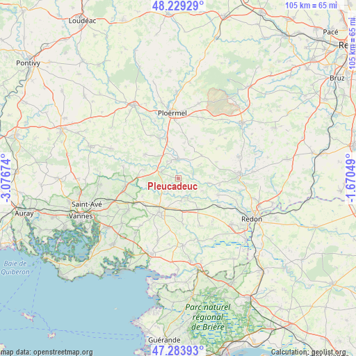
Pleucadeuc GPS coordinates[2]
47° 45' 31.536" North, 2° 22' 25.032" West
| Map corner | latitude | longitude |
|---|---|---|
| Upper-left | 48.22929°, | -3.07674° |
| Center: | 47.75876°, | -2.37362° |
| Lower-right: | 47.28393°, | -1.67049° |
| Map W x H: | 105.1×105.1 km | = 65.3×65.3mi |
| max Lat: | 51.07786° ⇑44.8% North |
| Pleucadeuc: | 47.75876° |
| min Lat: | ⇓55.2% South 41.3874° |
| min Long | Pleucadeuc | max Long |
| -5.08615° | -2.37362° | 9.52242° |
| W 4%⇐ | ⇒96% E |
Elevation
Elevation of Pleucadeuc is 71 m = 233 ft, and this is 122.7 m = 403 ft below average elevation for this country.
| Max E: |
2333 m = 7654 ft | 73.1% |
| Avg. | 193.7 m = 635 ft | |
| Pleucadeuc | 71 m = 233 ft | |
Min E: |
-1 m = -3 ft | 26.9% |
See also: France elevation on elevation.city.
Geographical zone
Pleucadeuc is located in North temperate zone (between Tropic of Cancer and the Arctic Circle). Distance of this North polar circle is 2090.9 km =1299.2 mi to North.| Distance of | km | miles | from Pleucadeuc |
|---|---|---|---|
| North Pole | 4696.8 | 2918.5 | to North |
| Arctic Circle | 2090.9 | 1299.2 | to North |
| Tropic Cancer | 2704.4 | 1680.4 | to South |
| Equator | 5310.3 | 3299.7 | to South |


Nearby cities:
15 places around Pleucadeuc: (largest is in red/bold)
• Bohal
5.4 km =3.4 mi,  297°
297°
• Larré
11.8 km =7.3 mi,  243°
243°
• Les Fougerêts
12.2 km =7.6 mi,  99°
99°
• Malansac
10.8 km =6.7 mi,  147°
147°
• Malestroit
5.7 km =3.5 mi,  351°
351°
• Missiriac
8.7 km =5.4 mi,  11°
11°
• Molac
5.6 km =3.5 mi, 235°
• Pluherlin
7 km =4.3 mi,  173°
173°
• Rochefort-en-Terre
7.2 km =4.5 mi,  155°
155°
• Ruffiac
9.5 km =5.9 mi,  45°
45°
• Saint-Congard
4.4 km =2.7 mi,  73°
73°
• Saint-Gravé
7.9 km =4.9 mi,  117°
117°
• Saint-Guyomard
10.8 km =6.7 mi,  283°
283°
• Saint-Marcel
6.1 km =3.8 mi,  325°
325°
• Saint-Martin-sur-Oust
9.1 km =5.7 mi, 98°
Sources, notices
• [Note1] Compared only with cities in France existing in our database
• [Src1] Map data: © OpenStreetMap contributors (CC-BY-SA)
• [Src2] Other city data from geonames.org with taken over terms of usage.
• [Src3] Geographical zone / Annual Mean Temperature by Robert A. Rohde @ Wikipedia
