Rochefort-en-Terre geodata
Rochefort-en-Terre (Brittany) is a populated place; located in France in Europe/Paris (GMT+2) time zone. With population of 682 people, there are 12047 cities with bigger population in this country. Compared to other cities in France, 54.2% of cities are located further ↓South; 95.9% of cities are located further →East and 88.6% of cities have higher elevation than Rochefort-en-Terre. Note1
Administrative division(s):
- Level 1: Brittany
- Level 2: Morbihan
- Level 3: Arrondissement de Vannes
- Level 4: Rochefort-en-Terre


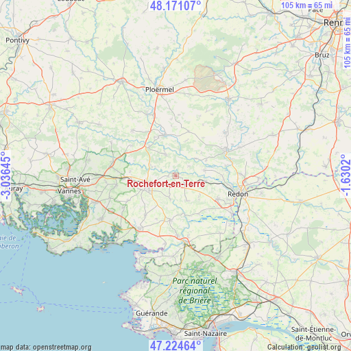
Rochefort-en-Terre GPS coordinates[2]
47° 42' 0" North, 2° 19' 59.988" West
| Map corner | latitude | longitude |
|---|---|---|
| Upper-left | 48.17107°, | -3.03645° |
| Center: | 47.7°, | -2.33333° |
| Lower-right: | 47.22464°, | -1.6302° |
| Map W x H: | 105.2×105.2 km | = 65.4×65.4mi |
| max Lat: | 51.07786° ⇑45.8% North |
| Rochefort-en-Terre: | 47.7° |
| min Lat: | ⇓54.2% South 41.3874° |
| min Long | Rochefort-en-Te | max Long |
| -5.08615° | -2.33333° | 9.52242° |
| W 4.1%⇐ | ⇒95.9% E |
Elevation
Elevation of Rochefort-en-Terre is 33 m = 108 ft, and this is 160.7 m = 527 ft below average elevation for this country.
| Max E: |
2333 m = 7654 ft | 88.6% |
| Avg. | 193.7 m = 635 ft | |
| Rochefort-en-Terre | 33 m = 108 ft | |
Min E: |
-1 m = -3 ft | 11.4% |
See also: France elevation on elevation.city.
Geographical zone
Rochefort-en-Terre is located in North temperate zone (between Tropic of Cancer and the Arctic Circle). Distance of this North polar circle is 2097.4 km =1303.3 mi to North.| Distance of | km | miles | from Rochefort-en-Terre |
|---|---|---|---|
| North Pole | 4703.3 | 2922.5 | to North |
| Arctic Circle | 2097.4 | 1303.3 | to North |
| Tropic Cancer | 2697.8 | 1676.3 | to South |
| Equator | 5303.7 | 3295.6 | to South |


Nearby cities:
15 places around Rochefort-en-Terre: (largest is in red/bold)
• Bohal
11.9 km =7.4 mi,  318°
318°
• Caden
8.4 km =5.2 mi,  155°
155°
• Les Fougerêts
10.1 km =6.3 mi,  63°
63°
• Limerzel
7.3 km =4.5 mi,  192°
192°
• Malansac
3.8 km =2.4 mi,  131°
131°
• Malestroit
12.7 km =7.9 mi,  342°
342°
• Molac
8.3 km =5.2 mi,  293°
293°
• Peillac
8.6 km =5.3 mi,  79°
79°
• Pleucadeuc
7.2 km =4.5 mi, 335°
• Pluherlin
2.3 km =1.4 mi,  259°
259°
• Questembert
9.8 km =6.1 mi,  245°
245°
• Saint-Congard
7.9 km =4.9 mi,  8°
8°
• Saint-Gravé
4.9 km =3 mi,  54°
54°
• Saint-Jacut-les-Pins
9 km =5.6 mi,  100°
100°
• Saint-Martin-sur-Oust
7.9 km =4.9 mi, 49°
Sources, notices
• [Note1] Compared only with cities in France existing in our database
• [Src1] Map data: © OpenStreetMap contributors (CC-BY-SA)
• [Src2] Other city data from geonames.org with taken over terms of usage.
• [Src3] Geographical zone / Annual Mean Temperature by Robert A. Rohde @ Wikipedia
