Pavant geodata
Pavant (Hauts-de-France) is a populated place; located in France in Europe/Paris (GMT+2) time zone. With population of 760 people, there are 11054 cities with bigger population in this country. Compared to other cities in France, 78.6% of cities are located further ↓South; 61.8% of cities are located further ←West and 74.1% of cities have higher elevation than Pavant. Note1
Administrative division(s):
- Level 1: Hauts-de-France
- Level 2: Département de l'Aisne
- Level 3: Arrondissement de Château-Thierry
- Level 4: Pavant


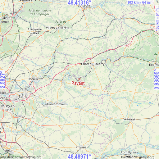
Pavant GPS coordinates[2]
48° 57' 12.852" North, 3° 17' 8.988" East
| Map corner | latitude | longitude |
|---|---|---|
| Upper-left | 49.41316°, | 2.5827° |
| Center: | 48.95357°, | 3.28583° |
| Lower-right: | 48.48971°, | 3.98895° |
| Map W x H: | 102.7×102.7 km | = 63.8×63.8mi |
| max Lat: | 51.07786° ⇑21.4% North |
| Pavant: | 48.95357° |
| min Lat: | ⇓78.6% South 41.3874° |
| min Long | Pavant | max Long |
| -5.08615° | 3.28583° | 9.52242° |
| W 61.8%⇐ | ⇒38.2% E |
Elevation
Elevation of Pavant is 69 m = 226 ft, and this is 124.7 m = 409 ft below average elevation for this country.
| Max E: |
2333 m = 7654 ft | 74.1% |
| Avg. | 193.7 m = 635 ft | |
| Pavant | 69 m = 226 ft | |
Min E: |
-1 m = -3 ft | 25.9% |
See also: France elevation on elevation.city.
Geographical zone
Pavant is located in North temperate zone (between Tropic of Cancer and the Arctic Circle). Distance of this North polar circle is 1958 km =1216.6 mi to North.| Distance of | km | miles | from Pavant |
|---|---|---|---|
| North Pole | 4563.9 | 2835.9 | to North |
| Arctic Circle | 1958 | 1216.6 | to North |
| Tropic Cancer | 2837.2 | 1763 | to South |
| Equator | 5443.1 | 3382.2 | to South |


Nearby cities:
15 places around Pavant: (largest is in red/bold)
• Charly-sur-Marne
2.7 km =1.7 mi,  358°
358°
• Chézy-sur-Marne
7.2 km =4.5 mi,  56°
56°
• Citry
3.7 km =2.3 mi,  295°
295°
• Domptin
7 km =4.3 mi, 355°
• Luzancy
7.9 km =4.9 mi,  285°
285°
• Méry-sur-Marne
6.4 km =4 mi,  281°
281°
• Nanteuil-sur-Marne
5.5 km =3.4 mi, 299°
• Nogent-l’Artaud
2.9 km =1.8 mi, 62°
• Orly-sur-Morin
6.8 km =4.2 mi,  216°
216°
• Sablonnières
8.7 km =5.4 mi,  174°
174°
• Saint-Cyr-sur-Morin
9.3 km =5.8 mi,  235°
235°
• Saint-Ouen-sur-Morin
8.4 km =5.2 mi,  227°
227°
• Sainte-Aulde
9.4 km =5.8 mi, 298°
• Saulchery
2.9 km =1.8 mi,  33°
33°
• Saâcy-sur-Marne
5.6 km =3.5 mi, 279°
Sources, notices
• [Note1] Compared only with cities in France existing in our database
• [Src1] Map data: © OpenStreetMap contributors (CC-BY-SA)
• [Src2] Other city data from geonames.org with taken over terms of usage.
• [Src3] Geographical zone / Annual Mean Temperature by Robert A. Rohde @ Wikipedia
