Parthenay-de-Bretagne geodata
Parthenay-de-Bretagne (Brittany) is a populated place; located in France in Europe/Paris (GMT+2) time zone. With population of 615 people, there are 13071 cities with bigger population in this country. Compared to other cities in France, 62.7% of cities are located further ↓South; 94.2% of cities are located further →East and 65.6% of cities have higher elevation than Parthenay-de-Bretagne. Note1
Administrative division(s):
- Level 1: Brittany
- Level 2: Département d'Ille-et-Vilaine
- Level 3: Arrondissement de Rennes
- Level 4: Parthenay-de-Bretagne


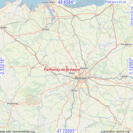
Parthenay-de-Bretagne GPS coordinates[2]
48° 11' 30.516" North, 1° 49' 44.58" West
| Map corner | latitude | longitude |
|---|---|---|
| Upper-left | 48.6584°, | -2.53218° |
| Center: | 48.19181°, | -1.82905° |
| Lower-right: | 47.72093°, | -1.12593° |
| Map W x H: | 104.2×104.2 km | = 64.7×64.7mi |
| max Lat: | 51.07786° ⇑37.3% North |
| Parthenay-de-Bretagne: | 48.19181° |
| min Lat: | ⇓62.7% South 41.3874° |
| min Long | Parthenay-de-Br | max Long |
| -5.08615° | -1.82905° | 9.52242° |
| W 5.8%⇐ | ⇒94.2% E |
Elevation
Elevation of Parthenay-de-Bretagne is 88 m = 289 ft, and this is 105.7 m = 347 ft below average elevation for this country.
| Max E: |
2333 m = 7654 ft | 65.6% |
| Avg. | 193.7 m = 635 ft | |
| Parthenay-de-Bretagne | 88 m = 289 ft | |
Min E: |
-1 m = -3 ft | 34.4% |
See also: France elevation on elevation.city.
Geographical zone
Parthenay-de-Bretagne is located in North temperate zone (between Tropic of Cancer and the Arctic Circle). Distance of this North polar circle is 2042.7 km =1269.3 mi to North.| Distance of | km | miles | from Parthenay-de-Bretagne |
|---|---|---|---|
| North Pole | 4648.6 | 2888.5 | to North |
| Arctic Circle | 2042.7 | 1269.3 | to North |
| Tropic Cancer | 2752.5 | 1710.3 | to South |
| Equator | 5358.4 | 3329.6 | to South |


Nearby cities:
15 places around Parthenay-de-Bretagne: (largest is in red/bold)
• Breteil
7.3 km =4.5 mi,  225°
225°
• Bédée
8.7 km =5.4 mi,  260°
260°
• Clayes
2.3 km =1.4 mi, 233°
• Gévezé
4.2 km =2.6 mi,  43°
43°
• La Chapelle-Thouarault
7.9 km =4.9 mi,  200°
200°
• La Chapelle-des-Fougeretz
7.4 km =4.6 mi,  102°
102°
• La Mézière
6.2 km =3.9 mi,  61°
61°
• Langan
6.2 km =3.9 mi,  343°
343°
• Langouet
6.4 km =4 mi,  3°
3°
• Pacé
6.3 km =3.9 mi,  139°
139°
• Pleumeleuc
6.8 km =4.2 mi, 262°
• Romillé
5.4 km =3.4 mi,  300°
300°
• Saint-Gilles
4.2 km =2.6 mi,  175°
175°
• Saint-Gondran
8.4 km =5.2 mi,  356°
356°
• Vignoc
7.2 km =4.5 mi,  29°
29°
Sources, notices
• [Note1] Compared only with cities in France existing in our database
• [Src1] Map data: © OpenStreetMap contributors (CC-BY-SA)
• [Src2] Other city data from geonames.org with taken over terms of usage.
• [Src3] Geographical zone / Annual Mean Temperature by Robert A. Rohde @ Wikipedia
