Langan geodata
Langan (Brittany) is a populated place; located in France in Europe/Paris (GMT+2) time zone. With population of 843 people, there are 10148 cities with bigger population in this country. Compared to other cities in France, 63.6% of cities are located further ↓South; 94.3% of cities are located further →East and 57.3% of cities have higher elevation than Langan. Note1
Administrative division(s):
- Level 1: Brittany
- Level 2: Département d'Ille-et-Vilaine
- Level 3: Arrondissement de Rennes
- Level 4: Langan


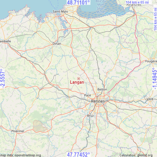
Langan GPS coordinates[2]
48° 14' 41.676" North, 1° 51' 9.288" West
| Map corner | latitude | longitude |
|---|---|---|
| Upper-left | 48.71101°, | -2.5557° |
| Center: | 48.24491°, | -1.85258° |
| Lower-right: | 47.77452°, | -1.14945° |
| Map W x H: | 104.1×104.1 km | = 64.7×64.7mi |
| max Lat: | 51.07786° ⇑36.4% North |
| Langan: | 48.24491° |
| min Lat: | ⇓63.6% South 41.3874° |
| min Long | Langan | max Long |
| -5.08615° | -1.85258° | 9.52242° |
| W 5.7%⇐ | ⇒94.3% E |
Elevation
Elevation of Langan is 110 m = 361 ft, and this is 83.7 m = 275 ft below average elevation for this country.
| Max E: |
2333 m = 7654 ft | 57.3% |
| Avg. | 193.7 m = 635 ft | |
| Langan | 110 m = 361 ft | |
Min E: |
-1 m = -3 ft | 42.7% |
See also: France elevation on elevation.city.
Geographical zone
Langan is located in North temperate zone (between Tropic of Cancer and the Arctic Circle). Distance of this North polar circle is 2036.8 km =1265.6 mi to North.| Distance of | km | miles | from Langan |
|---|---|---|---|
| North Pole | 4642.7 | 2884.8 | to North |
| Arctic Circle | 2036.8 | 1265.6 | to North |
| Tropic Cancer | 2758.4 | 1714 | to South |
| Equator | 5364.3 | 3333.2 | to South |


Nearby cities:
15 places around Langan: (largest is in red/bold)
• Bécherel
8.8 km =5.5 mi,  309°
309°
• Clayes
7.3 km =4.5 mi,  180°
180°
• Gévezé
5.5 km =3.4 mi,  121°
121°
• Hédé-Bazouges
7.3 km =4.5 mi,  32°
32°
• Irodouër
7.2 km =4.5 mi,  273°
273°
• La Baussaine
8.3 km =5.2 mi,  335°
335°
• La Chapelle-Chaussée
2.9 km =1.8 mi,  356°
356°
• La Mézière
7.8 km =4.8 mi,  112°
112°
• Langouet
2.2 km =1.4 mi,  76°
76°
• Miniac-sous-Bécherel
7.3 km =4.5 mi, 307°
• Parthenay-de-Bretagne
6.2 km =3.9 mi,  163°
163°
• Pleumeleuc
8.4 km =5.2 mi,  216°
216°
• Romillé
4.3 km =2.7 mi, 222°
• Saint-Gondran
2.7 km =1.7 mi, 25°
• Vignoc
5.3 km =3.3 mi,  85°
85°
Sources, notices
• [Note1] Compared only with cities in France existing in our database
• [Src1] Map data: © OpenStreetMap contributors (CC-BY-SA)
• [Src2] Other city data from geonames.org with taken over terms of usage.
• [Src3] Geographical zone / Annual Mean Temperature by Robert A. Rohde @ Wikipedia
