La Chapelle-des-Fougeretz geodata
La Chapelle-des-Fougeretz (Brittany) is a populated place; located in France in Europe/Paris (GMT+2) time zone. With population of 3,621 people, there are 2697 cities with bigger population in this country. Compared to other cities in France, 62.4% of cities are located further ↓South; 93.7% of cities are located further →East and 66.6% of cities have higher elevation than La Chapelle-des-Fougeretz. Note1
Administrative division(s):
- Level 1: Brittany
- Level 2: Département d'Ille-et-Vilaine
- Level 3: Arrondissement de Rennes
- Level 4: La Chapelle-des-Fougeretz
Current local time in La Chapelle-des-Fougeretz:
11:18 PM, SaturdayDifference from your time zone: hours


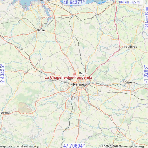
La Chapelle-des-Fougeretz GPS coordinates[2]
48° 10' 37.38" North, 1° 43' 53.148" West
| Map corner | latitude | longitude |
|---|---|---|
| Upper-left | 48.64377°, | -2.43455° |
| Center: | 48.17705°, | -1.73143° |
| Lower-right: | 47.70604°, | -1.0283° |
| Map W x H: | 104.3×104.3 km | = 64.8×64.8mi |
| max Lat: | 51.07786° ⇑37.6% North |
| La Chapelle-des-Fougeretz: | 48.17705° |
| min Lat: | ⇓62.4% South 41.3874° |
| min Long | La Chapelle-des | max Long |
| -5.08615° | -1.73143° | 9.52242° |
| W 6.3%⇐ | ⇒93.7% E |
Elevation
Elevation of La Chapelle-des-Fougeretz is 86 m = 282 ft, and this is 107.7 m = 353 ft below average elevation for this country.
| Max E: |
2333 m = 7654 ft | 66.6% |
| Avg. | 193.7 m = 635 ft | |
| La Chapelle-des-Fougeretz | 86 m = 282 ft | |
Min E: |
-1 m = -3 ft | 33.4% |
See also: France elevation on elevation.city.
Geographical zone
La Chapelle-des-Fougeretz is located in North temperate zone (between Tropic of Cancer and the Arctic Circle). Distance of this North polar circle is 2044.4 km =1270.3 mi to North.| Distance of | km | miles | from La Chapelle-des-Fougeretz |
|---|---|---|---|
| North Pole | 4650.3 | 2889.6 | to North |
| Arctic Circle | 2044.4 | 1270.3 | to North |
| Tropic Cancer | 2750.9 | 1709.3 | to South |
| Equator | 5356.8 | 3328.6 | to South |


Nearby cities:
15 places around La Chapelle-des-Fougeretz: (largest is in red/bold)
• Betton
6.9 km =4.3 mi,  86°
86°
• Chevaigné
8.5 km =5.3 mi,  63°
63°
• Clayes
9.1 km =5.7 mi,  271°
271°
• Gévezé
6.4 km =4 mi,  317°
317°
• La Mézière
4.9 km =3 mi,  339°
339°
• Melesse
5.3 km =3.3 mi,  30°
30°
• Montgermont
2.7 km =1.7 mi,  152°
152°
• Montreuil-le-Gast
7.7 km =4.8 mi,  3°
3°
• Pacé
4.4 km =2.7 mi,  224°
224°
• Parthenay-de-Bretagne
7.4 km =4.6 mi,  282°
282°
• Rennes
8.4 km =5.2 mi, 149°
• Saint-Gilles
7.4 km =4.6 mi,  249°
249°
• Saint-Grégoire
4.4 km =2.7 mi,  131°
131°
• Vezin-le-Coquet
6.7 km =4.2 mi,  194°
194°
• Vignoc
8.8 km =5.5 mi,  334°
334°
Sources, notices
• [Note1] Compared only with cities in France existing in our database
• [Src1] Map data: © OpenStreetMap contributors (CC-BY-SA)
• [Src2] Other city data from geonames.org with taken over terms of usage.
• [Src3] Geographical zone / Annual Mean Temperature by Robert A. Rohde @ Wikipedia
