Parcey geodata
Parcey (Bourgogne-Franche-Comté) is a populated place; located in France in Europe/Paris (GMT+2) time zone. With population of 936 people, there are 9332 cities with bigger population in this country. Compared to other cities in France, 55.1% of cities are located further ↑North; 82.8% of cities are located further ←West and 65.6% of cities have lower elevation than Parcey. Note1
Administrative division(s):
- Level 1: Bourgogne-Franche-Comté
- Level 2: Jura
- Level 3: Arrondissement de Dole
- Level 4: Parcey


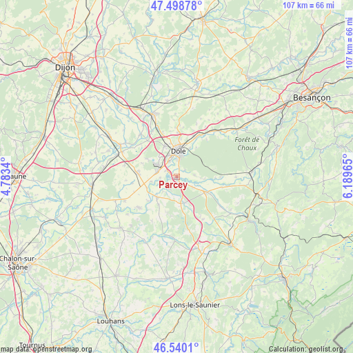
Parcey GPS coordinates[2]
47° 1' 17.724" North, 5° 29' 11.508" East
| Map corner | latitude | longitude |
|---|---|---|
| Upper-left | 47.49878°, | 4.7834° |
| Center: | 47.02159°, | 5.48653° |
| Lower-right: | 46.5401°, | 6.18965° |
| Map W x H: | 106.6×106.6 km | = 66.2×66.2mi |
| max Lat: | 51.07786° ⇑55.1% North |
| Parcey: | 47.02159° |
| min Lat: | ⇓44.9% South 41.3874° |
| min Long | Parcey | max Long |
| -5.08615° | 5.48653° | 9.52242° |
| W 82.8%⇐ | ⇒17.2% E |
Elevation
Elevation of Parcey is 197 m = 646 ft, and this is 3.3 m = 11 ft above average elevation for this country.
| Max E: |
2333 m = 7654 ft | 34.4% |
| Parcey | 197 m 646 ft | |
| Avg. | 193.7 m = 635 ft | |
Min E: |
-1 m = -3 ft | 65.6% |
See also: France elevation on elevation.city.
Geographical zone
Parcey is located in North temperate zone (between Tropic of Cancer and the Arctic Circle). Distance of this North polar circle is 2172.9 km =1350.2 mi to North.| Distance of | km | miles | from Parcey |
|---|---|---|---|
| North Pole | 4778.8 | 2969.4 | to North |
| Arctic Circle | 2172.9 | 1350.2 | to North |
| Tropic Cancer | 2622.4 | 1629.5 | to South |
| Equator | 5228.3 | 3248.7 | to South |


Nearby cities:
15 places around Parcey: (largest is in red/bold)
• Asnans-Beauvoisin
9.6 km =6 mi,  213°
213°
• Brevans
8.9 km =5.5 mi,  19°
19°
• Champvans
10 km =6.2 mi,  338°
338°
• Chaussin
8.6 km =5.3 mi,  224°
224°
• Choisey
5.1 km =3.2 mi, 336°
• Crissey
5.2 km =3.2 mi,  357°
357°
• Damparis
8.1 km =5 mi,  317°
317°
• Dole
7.9 km =4.9 mi,  1°
1°
• Foucherans
7 km =4.3 mi, 340°
• Gevry
3.8 km =2.4 mi,  301°
301°
• La Loye
5.4 km =3.4 mi,  84°
84°
• Le Deschaux
7.8 km =4.8 mi,  171°
171°
• Mont-sous-Vaudrey
10 km =6.2 mi,  118°
118°
• Tavaux
6.3 km =3.9 mi,  282°
282°
• Villette-lès-Dole
2.8 km =1.7 mi, 15°
Sources, notices
• [Note1] Compared only with cities in France existing in our database
• [Src1] Map data: © OpenStreetMap contributors (CC-BY-SA)
• [Src2] Other city data from geonames.org with taken over terms of usage.
• [Src3] Geographical zone / Annual Mean Temperature by Robert A. Rohde @ Wikipedia
