Parçay-Meslay geodata
Parçay-Meslay (Centre) is a populated place; located in France in Europe/Paris (GMT+2) time zone. With population of 2,305 people, there are 4187 cities with bigger population in this country. Compared to other cities in France, 50.4% of cities are located further ↓South; 71% of cities are located further →East and 59.4% of cities have higher elevation than Parçay-Meslay. Note1
Administrative division(s):
- Level 1: Centre
- Level 2: Département d'Indre-et-Loire
- Level 3: Arrondissement de Tours
- Level 4: Parçay-Meslay


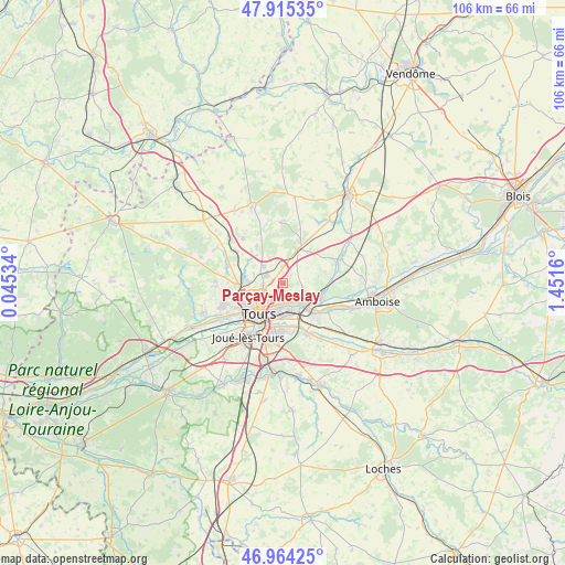
Parçay-Meslay GPS coordinates[2]
47° 26' 31.02" North, 0° 44' 54.492" East
| Map corner | latitude | longitude |
|---|---|---|
| Upper-left | 47.91535°, | 0.04534° |
| Center: | 47.44195°, | 0.74847° |
| Lower-right: | 46.96425°, | 1.4516° |
| Map W x H: | 105.8×105.8 km | = 65.7×65.7mi |
| max Lat: | 51.07786° ⇑49.6% North |
| Parçay-Meslay: | 47.44195° |
| min Lat: | ⇓50.4% South 41.3874° |
| min Long | Parçay-Meslay | max Long |
| -5.08615° | 0.74847° | 9.52242° |
| W 29%⇐ | ⇒71% E |
Elevation
Elevation of Parçay-Meslay is 104 m = 341 ft, and this is 89.7 m = 294 ft below average elevation for this country.
| Max E: |
2333 m = 7654 ft | 59.4% |
| Avg. | 193.7 m = 635 ft | |
| Parçay-Meslay | 104 m = 341 ft | |
Min E: |
-1 m = -3 ft | 40.6% |
See also: France elevation on elevation.city.
Geographical zone
Parçay-Meslay is located in North temperate zone (between Tropic of Cancer and the Arctic Circle). Distance of this North polar circle is 2126.1 km =1321.1 mi to North.| Distance of | km | miles | from Parçay-Meslay |
|---|---|---|---|
| North Pole | 4732 | 2940.3 | to North |
| Arctic Circle | 2126.1 | 1321.1 | to North |
| Tropic Cancer | 2669.1 | 1658.5 | to South |
| Equator | 5275.1 | 3277.8 | to South |


Nearby cities:
15 places around Parçay-Meslay: (largest is in red/bold)
• Cerelles
8.3 km =5.2 mi,  323°
323°
• Chanceaux-sur-Choisille
4.6 km =2.9 mi, 315°
• La Riche
8.2 km =5.1 mi,  225°
225°
• La Ville-aux-Dames
5.4 km =3.4 mi,  163°
163°
• Larçay
8.7 km =5.4 mi, 163°
• Mettray
7.5 km =4.7 mi,  278°
278°
• Monnaie
7.3 km =4.5 mi,  24°
24°
• Montlouis-sur-Loire
8.7 km =5.4 mi,  133°
133°
• Rochecorbon
2.9 km =1.8 mi,  169°
169°
• Saint-Avertin
8.7 km =5.4 mi,  184°
184°
• Saint-Cyr-sur-Loire
7.7 km =4.8 mi, 232°
• Saint-Pierre-des-Corps
6.2 km =3.9 mi, 179°
• Tours
6.2 km =3.9 mi,  212°
212°
• Vernou-sur-Brenne
7.9 km =4.9 mi,  108°
108°
• Vouvray
5.1 km =3.2 mi, 132°
Sources, notices
• [Note1] Compared only with cities in France existing in our database
• [Src1] Map data: © OpenStreetMap contributors (CC-BY-SA)
• [Src2] Other city data from geonames.org with taken over terms of usage.
• [Src3] Geographical zone / Annual Mean Temperature by Robert A. Rohde @ Wikipedia
