Tours geodata
Tours (Centre) is a seat of a second-order administrative division; located in France in Europe/Paris (GMT+2) time zone. With population of 141,621 people, there are 25 cities with bigger population in this country. Compared to other cities in France, 50.2% of cities are located further ↑North; 71.4% of cities are located further →East and 82.2% of cities have higher elevation than Tours. Note1
Administrative division(s):
- Level 1: Centre
- Level 2: Département d'Indre-et-Loire
- Level 3: Arrondissement de Tours
- Level 4: Tours


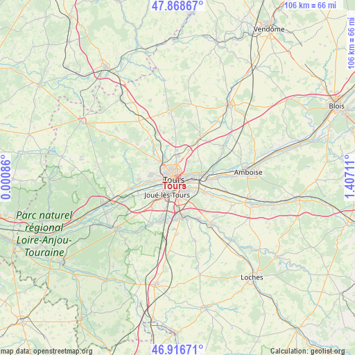
Tours GPS coordinates[2]
47° 23' 41.424" North, 0° 42' 14.328" East
| Map corner | latitude | longitude |
|---|---|---|
| Upper-left | 47.86867°, | 0.00086° |
| Center: | 47.39484°, | 0.70398° |
| Lower-right: | 46.91671°, | 1.40711° |
| Map W x H: | 105.8×105.8 km | = 65.7×65.7mi |
| max Lat: | 51.07786° ⇑50.2% North |
| Tours: | 47.39484° |
| min Lat: | ⇓49.8% South 41.3874° |
| min Long | Tours | max Long |
| -5.08615° | 0.70398° | 9.52242° |
| W 28.6%⇐ | ⇒71.4% E |
Elevation
Elevation of Tours is 49 m = 161 ft, and this is 144.7 m = 475 ft below average elevation for this country.
| Max E: |
2333 m = 7654 ft | 82.2% |
| Avg. | 193.7 m = 635 ft | |
| Tours | 49 m = 161 ft | |
Min E: |
-1 m = -3 ft | 17.8% |
See also: Tours elevation on elevation.city.
Geographical zone
Tours is located in North temperate zone (between Tropic of Cancer and the Arctic Circle). Distance of this North polar circle is 2131.4 km =1324.4 mi to North.| Distance of | km | miles | from Tours |
|---|---|---|---|
| North Pole | 4737.2 | 2943.6 | to North |
| Arctic Circle | 2131.4 | 1324.4 | to North |
| Tropic Cancer | 2663.9 | 1655.3 | to South |
| Equator | 5269.8 | 3274.5 | to South |


Nearby cities:
15 places around Tours: (largest is in red/bold)
• Chambray-lès-Tours
6.6 km =4.1 mi,  180°
180°
• Fondettes
8.1 km =5 mi,  276°
276°
• Joué-lès-Tours
5.4 km =3.4 mi,  209°
209°
• La Membrolle-sur-Choisille
7.2 km =4.5 mi,  310°
310°
• La Riche
2.6 km =1.6 mi,  257°
257°
• La Ville-aux-Dames
4.8 km =3 mi,  89°
89°
• Larçay
6.6 km =4.1 mi,  118°
118°
• Mettray
7.6 km =4.7 mi,  327°
327°
• Parçay-Meslay
6.2 km =3.9 mi,  32°
32°
• Rochecorbon
4.6 km =2.9 mi,  57°
57°
• Saint-Avertin
4.4 km =2.7 mi,  142°
142°
• Saint-Cyr-sur-Loire
2.9 km =1.8 mi, 281°
• Saint-Genouph
8.2 km =5.1 mi, 256°
• Saint-Pierre-des-Corps
3.5 km =2.2 mi,  105°
105°
• Vouvray
7.4 km =4.6 mi,  75°
75°
Sources, notices
• [Note1] Compared only with cities in France existing in our database
• [Src1] Map data: © OpenStreetMap contributors (CC-BY-SA)
• [Src2] Other city data from geonames.org with taken over terms of usage.
• [Src3] Geographical zone / Annual Mean Temperature by Robert A. Rohde @ Wikipedia
