Mettray geodata
Mettray (Centre) is a populated place; located in France in Europe/Paris (GMT+2) time zone. With population of 1,914 people, there are 5002 cities with bigger population in this country. Compared to other cities in France, 50.5% of cities are located further ↓South; 71.9% of cities are located further →East and 77% of cities have higher elevation than Mettray. Note1
Administrative division(s):
- Level 1: Centre
- Level 2: Département d'Indre-et-Loire
- Level 3: Arrondissement de Tours
- Level 4: Mettray


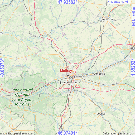
Mettray GPS coordinates[2]
47° 27' 9.036" North, 0° 38' 57.804" East
| Map corner | latitude | longitude |
|---|---|---|
| Upper-left | 47.92582°, | -0.05373° |
| Center: | 47.45251°, | 0.64939° |
| Lower-right: | 46.97491°, | 1.35252° |
| Map W x H: | 105.7×105.7 km | = 65.7×65.7mi |
| max Lat: | 51.07786° ⇑49.5% North |
| Mettray: | 47.45251° |
| min Lat: | ⇓50.5% South 41.3874° |
| min Long | Mettray | max Long |
| -5.08615° | 0.64939° | 9.52242° |
| W 28.1%⇐ | ⇒71.9% E |
Elevation
Elevation of Mettray is 62 m = 203 ft, and this is 131.7 m = 432 ft below average elevation for this country.
| Max E: |
2333 m = 7654 ft | 77% |
| Avg. | 193.7 m = 635 ft | |
| Mettray | 62 m = 203 ft | |
Min E: |
-1 m = -3 ft | 23% |
See also: France elevation on elevation.city.
Geographical zone
Mettray is located in North temperate zone (between Tropic of Cancer and the Arctic Circle). Distance of this North polar circle is 2124.9 km =1320.4 mi to North.| Distance of | km | miles | from Mettray |
|---|---|---|---|
| North Pole | 4730.8 | 2939.6 | to North |
| Arctic Circle | 2124.9 | 1320.4 | to North |
| Tropic Cancer | 2670.3 | 1659.2 | to South |
| Equator | 5276.2 | 3278.5 | to South |


Nearby cities:
15 places around Mettray: (largest is in red/bold)
• Cerelles
6 km =3.7 mi,  25°
25°
• Chanceaux-sur-Choisille
4.7 km =2.9 mi,  63°
63°
• Charentilly
3.6 km =2.2 mi,  302°
302°
• Fondettes
6.7 km =4.2 mi,  215°
215°
• La Membrolle-sur-Choisille
2.2 km =1.4 mi, 218°
• La Riche
7.1 km =4.4 mi,  167°
167°
• Parçay-Meslay
7.5 km =4.7 mi,  98°
98°
• Rochecorbon
8.9 km =5.5 mi,  116°
116°
• Rouziers-de-Touraine
7.2 km =4.5 mi,  359°
359°
• Saint-Antoine-du-Rocher
5.1 km =3.2 mi,  343°
343°
• Saint-Cyr-sur-Loire
6 km =3.7 mi, 167°
• Saint-Genouph
9.2 km =5.7 mi,  204°
204°
• Saint-Roch
5 km =3.1 mi,  256°
256°
• Semblançay
7.2 km =4.5 mi,  316°
316°
• Tours
7.6 km =4.7 mi,  147°
147°
Sources, notices
• [Note1] Compared only with cities in France existing in our database
• [Src1] Map data: © OpenStreetMap contributors (CC-BY-SA)
• [Src2] Other city data from geonames.org with taken over terms of usage.
• [Src3] Geographical zone / Annual Mean Temperature by Robert A. Rohde @ Wikipedia
