Pacy-sur-Eure geodata
Pacy-sur-Eure (Normandy) is a populated place; located in France in Europe/Paris (GMT+2) time zone. With population of 5,201 people, there are 1894 cities with bigger population in this country. Compared to other cities in France, 80.1% of cities are located further ↓South; 64.5% of cities are located further →East and 81.5% of cities have higher elevation than Pacy-sur-Eure. Note1
Administrative division(s):
- Level 1: Normandy
- Level 2: Département de l'Eure
- Level 3: Les Andelys
- Level 4: Pacy-sur-Eure


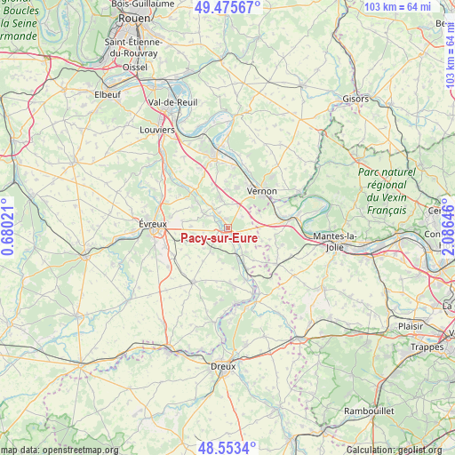
Pacy-sur-Eure GPS coordinates[2]
49° 1' 0.012" North, 1° 22' 59.988" East
| Map corner | latitude | longitude |
|---|---|---|
| Upper-left | 49.47567°, | 0.68021° |
| Center: | 49.01667°, | 1.38333° |
| Lower-right: | 48.5534°, | 2.08646° |
| Map W x H: | 102.5×102.5 km | = 63.7×63.7mi |
| max Lat: | 51.07786° ⇑19.9% North |
| Pacy-sur-Eure: | 49.01667° |
| min Lat: | ⇓80.1% South 41.3874° |
| min Long | Pacy-sur-Eure | max Long |
| -5.08615° | 1.38333° | 9.52242° |
| W 35.5%⇐ | ⇒64.5% E |
Elevation
Elevation of Pacy-sur-Eure is 51 m = 167 ft, and this is 142.7 m = 468 ft below average elevation for this country.
| Max E: |
2333 m = 7654 ft | 81.5% |
| Avg. | 193.7 m = 635 ft | |
| Pacy-sur-Eure | 51 m = 167 ft | |
Min E: |
-1 m = -3 ft | 18.5% |
See also: France elevation on elevation.city.
Geographical zone
Pacy-sur-Eure is located in North temperate zone (between Tropic of Cancer and the Arctic Circle). Distance of this North polar circle is 1951 km =1212.3 mi to North.| Distance of | km | miles | from Pacy-sur-Eure |
|---|---|---|---|
| North Pole | 4556.9 | 2831.5 | to North |
| Arctic Circle | 1951 | 1212.3 | to North |
| Tropic Cancer | 2844.2 | 1767.3 | to South |
| Equator | 5450.1 | 3386.5 | to South |


Nearby cities:
15 places around Pacy-sur-Eure: (largest is in red/bold)
• Blaru
7.8 km =4.8 mi,  63°
63°
• Breuilpont
6.7 km =4.2 mi,  150°
150°
• Bueil
10.4 km =6.5 mi,  155°
155°
• Cierrey
7.8 km =4.8 mi,  261°
261°
• Fontaine-sous-Jouy
8.7 km =5.4 mi,  309°
309°
• Houlbec-Cocherel
6.4 km =4 mi,  348°
348°
• Jouy-sur-Eure
7.1 km =4.4 mi,  303°
303°
• La Chapelle-Réanville
9 km =5.6 mi,  359°
359°
• Le Val-David
10.4 km =6.5 mi,  249°
249°
• Lommoye
9.8 km =6.1 mi,  105°
105°
• Miserey
8.3 km =5.2 mi,  273°
273°
• Ménilles
2.2 km =1.4 mi,  326°
326°
• Saint-Aquilin-de-Pacy
1.7 km =1.1 mi, 251°
• Saint-Marcel
10.5 km =6.5 mi,  27°
27°
• Vernon
10.3 km =6.4 mi, 34°
Sources, notices
• [Note1] Compared only with cities in France existing in our database
• [Src1] Map data: © OpenStreetMap contributors (CC-BY-SA)
• [Src2] Other city data from geonames.org with taken over terms of usage.
• [Src3] Geographical zone / Annual Mean Temperature by Robert A. Rohde @ Wikipedia
