Houlbec-Cocherel geodata
Houlbec-Cocherel (Normandy) is a populated place; located in France in Europe/Paris (GMT+2) time zone. With population of 1,378 people, there are 6687 cities with bigger population in this country. Compared to other cities in France, 81.4% of cities are located further ↓South; 64.8% of cities are located further →East and 50.6% of cities have lower elevation than Houlbec-Cocherel. Note1
Administrative division(s):
- Level 1: Normandy
- Level 2: Département de l'Eure
- Level 3: Les Andelys
- Level 4: Houlbec-Cocherel


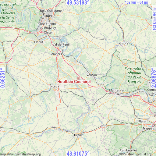
Houlbec-Cocherel GPS coordinates[2]
49° 4' 24.6" North, 1° 21' 56.268" East
| Map corner | latitude | longitude |
|---|---|---|
| Upper-left | 49.53198°, | 0.66251° |
| Center: | 49.0735°, | 1.36563° |
| Lower-right: | 48.61075°, | 2.06876° |
| Map W x H: | 102.4×102.4 km | = 63.6×63.6mi |
| max Lat: | 51.07786° ⇑18.6% North |
| Houlbec-Cocherel: | 49.0735° |
| min Lat: | ⇓81.4% South 41.3874° |
| min Long | Houlbec-Cochere | max Long |
| -5.08615° | 1.36563° | 9.52242° |
| W 35.2%⇐ | ⇒64.8% E |
Elevation
Elevation of Houlbec-Cocherel is 134 m = 440 ft, and this is 59.7 m = 196 ft below average elevation for this country.
| Max E: |
2333 m = 7654 ft | 49.4% |
| Avg. | 193.7 m = 635 ft | |
| Houlbec-Cocherel | 134 m = 440 ft | |
Min E: |
-1 m = -3 ft | 50.6% |
See also: France elevation on elevation.city.
Geographical zone
Houlbec-Cocherel is located in North temperate zone (between Tropic of Cancer and the Arctic Circle). Distance of this North polar circle is 1944.7 km =1208.4 mi to North.| Distance of | km | miles | from Houlbec-Cocherel |
|---|---|---|---|
| North Pole | 4550.6 | 2827.6 | to North |
| Arctic Circle | 1944.7 | 1208.4 | to North |
| Tropic Cancer | 2850.5 | 1771.2 | to South |
| Equator | 5456.5 | 3390.5 | to South |


Nearby cities:
15 places around Houlbec-Cocherel: (largest is in red/bold)
• Autheuil-Authouillet
6.7 km =4.2 mi,  296°
296°
• Blaru
8.8 km =5.5 mi,  108°
108°
• Fontaine-sous-Jouy
5.4 km =3.4 mi,  261°
261°
• Jouy-sur-Eure
5.3 km =3.3 mi,  242°
242°
• La Chapelle-Réanville
2.9 km =1.8 mi,  24°
24°
• Ménilles
4.5 km =2.8 mi,  179°
179°
• Pacy-sur-Eure
6.4 km =4 mi,  168°
168°
• Saint-Aquilin-de-Pacy
6.9 km =4.3 mi, 182°
• Saint-Aubin-sur-Gaillon
8.6 km =5.3 mi,  341°
341°
• Saint-Just
6.7 km =4.2 mi,  54°
54°
• Saint-Marcel
6.8 km =4.2 mi,  64°
64°
• Saint-Pierre-de-Bailleul
5.9 km =3.7 mi, 19°
• Saint-Pierre-la-Garenne
8.4 km =5.2 mi, 15°
• Vernon
7.4 km =4.6 mi,  73°
73°
• Écardenville-sur-Eure
7.7 km =4.8 mi,  294°
294°
Sources, notices
• [Note1] Compared only with cities in France existing in our database
• [Src1] Map data: © OpenStreetMap contributors (CC-BY-SA)
• [Src2] Other city data from geonames.org with taken over terms of usage.
• [Src3] Geographical zone / Annual Mean Temperature by Robert A. Rohde @ Wikipedia
