Ottange geodata
Ottange (Grand Est) is a populated place; located in France in Europe/Paris (GMT+2) time zone. With population of 2,666 people, there are 3662 cities with bigger population in this country. Compared to other cities in France, 88.5% of cities are located further ↓South; 87.2% of cities are located further ←West and 86.9% of cities have lower elevation than Ottange. Note1
Administrative division(s):
- Level 1: Grand Est
- Level 2: Moselle
- Level 3: Arrondissement de Thionville
- Level 4: Ottange


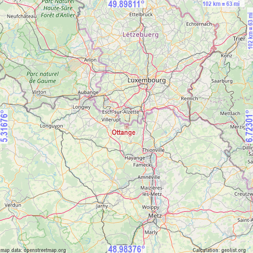
Ottange GPS coordinates[2]
49° 26' 35.052" North, 6° 1' 11.568" East
| Map corner | latitude | longitude |
|---|---|---|
| Upper-left | 49.89811°, | 5.31676° |
| Center: | 49.44307°, | 6.01988° |
| Lower-right: | 48.98376°, | 6.72301° |
| Map W x H: | 101.7×101.7 km | = 63.2×63.2mi |
| max Lat: | 51.07786° ⇑11.5% North |
| Ottange: | 49.44307° |
| min Lat: | ⇓88.5% South 41.3874° |
| min Long | Ottange | max Long |
| -5.08615° | 6.01988° | 9.52242° |
| W 87.2%⇐ | ⇒12.8% E |
Elevation
Elevation of Ottange is 371 m = 1217 ft, and this is 177.3 m = 582 ft above average elevation for this country.
| Max E: |
2333 m = 7654 ft | 13.1% |
| Ottange | 371 m 1217 ft | |
| Avg. | 193.7 m = 635 ft | |
Min E: |
-1 m = -3 ft | 86.9% |
See also: France elevation on elevation.city.
Geographical zone
Ottange is located in North temperate zone (between Tropic of Cancer and the Arctic Circle). Distance of this North polar circle is 1903.6 km =1182.8 mi to North.| Distance of | km | miles | from Ottange |
|---|---|---|---|
| North Pole | 4509.5 | 2802.1 | to North |
| Arctic Circle | 1903.6 | 1182.8 | to North |
| Tropic Cancer | 2891.6 | 1796.8 | to South |
| Equator | 5497.6 | 3416 | to South |


Nearby cities:
15 places around Ottange: (largest is in red/bold)
• Angevillers
6.4 km =4 mi,  163°
163°
• Audun-le-Tiche
5.7 km =3.5 mi,  304°
304°
• Aumetz
6.1 km =3.8 mi,  242°
242°
• Boulange
8.4 km =5.2 mi,  216°
216°
• Crusnes
7.6 km =4.7 mi,  262°
262°
• Entrange
7 km =4.3 mi,  118°
118°
• Errouville
9 km =5.6 mi,  250°
250°
• Escherange
4.9 km =3 mi,  128°
128°
• Kanfen
6.5 km =4 mi,  94°
94°
• Russange
6.6 km =4.1 mi,  312°
312°
• Thil
8.7 km =5.4 mi,  292°
292°
• Tressange
5.3 km =3.3 mi,  212°
212°
• Villerupt
6.9 km =4.3 mi, 292°
• Volmerange-les-Mines
4.4 km =2.7 mi, 89°
• Zoufftgen
8.5 km =5.3 mi,  75°
75°
Sources, notices
• [Note1] Compared only with cities in France existing in our database
• [Src1] Map data: © OpenStreetMap contributors (CC-BY-SA)
• [Src2] Other city data from geonames.org with taken over terms of usage.
• [Src3] Geographical zone / Annual Mean Temperature by Robert A. Rohde @ Wikipedia
