Boulange geodata
Boulange (Grand Est) is a populated place; located in France in Europe/Paris (GMT+2) time zone. With population of 1,844 people, there are 5139 cities with bigger population in this country. Compared to other cities in France, 87.6% of cities are located further ↓South; 86.5% of cities are located further ←West and 82.7% of cities have lower elevation than Boulange. Note1
Administrative division(s):
- Level 1: Grand Est
- Level 2: Moselle
- Level 3: Arrondissement de Thionville
- Level 4: Boulange


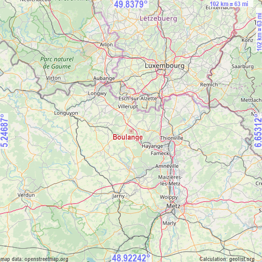
Boulange GPS coordinates[2]
49° 22' 56.244" North, 5° 57' 0" East
| Map corner | latitude | longitude |
|---|---|---|
| Upper-left | 49.8379°, | 5.24687° |
| Center: | 49.38229°, | 5.95° |
| Lower-right: | 48.92242°, | 6.65312° |
| Map W x H: | 101.8×101.8 km | = 63.3×63.3mi |
| max Lat: | 51.07786° ⇑12.4% North |
| Boulange: | 49.38229° |
| min Lat: | ⇓87.6% South 41.3874° |
| min Long | Boulange | max Long |
| -5.08615° | 5.95° | 9.52242° |
| W 86.5%⇐ | ⇒13.5% E |
Elevation
Elevation of Boulange is 318 m = 1043 ft, and this is 124.3 m = 408 ft above average elevation for this country.
| Max E: |
2333 m = 7654 ft | 17.3% |
| Boulange | 318 m 1043 ft | |
| Avg. | 193.7 m = 635 ft | |
Min E: |
-1 m = -3 ft | 82.7% |
See also: France elevation on elevation.city.
Geographical zone
Boulange is located in North temperate zone (between Tropic of Cancer and the Arctic Circle). Distance of this North polar circle is 1910.4 km =1187.1 mi to North.| Distance of | km | miles | from Boulange |
|---|---|---|---|
| North Pole | 4516.3 | 2806.3 | to North |
| Arctic Circle | 1910.4 | 1187.1 | to North |
| Tropic Cancer | 2884.9 | 1792.6 | to South |
| Equator | 5490.8 | 3411.8 | to South |


Nearby cities:
15 places around Boulange: (largest is in red/bold)
• Algrange
7.6 km =4.7 mi,  106°
106°
• Angevillers
6.9 km =4.3 mi,  84°
84°
• Audun-le-Roman
4.2 km =2.6 mi,  250°
250°
• Aumetz
4 km =2.5 mi,  353°
353°
• Crusnes
6.3 km =3.9 mi,  336°
336°
• Errouville
5.1 km =3.2 mi,  317°
317°
• Fontoy
4.2 km =2.6 mi,  133°
133°
• Knutange
8 km =5 mi, 126°
• Neufchef
9.1 km =5.7 mi,  143°
143°
• Nilvange
8.5 km =5.3 mi,  121°
121°
• Ottange
8.4 km =5.2 mi,  36°
36°
• Serrouville
4.8 km =3 mi,  292°
292°
• Tressange
3.2 km =2 mi, 44°
• Trieux
6.6 km =4.1 mi,  192°
192°
• Tucquegnieux
9 km =5.6 mi,  206°
206°
Sources, notices
• [Note1] Compared only with cities in France existing in our database
• [Src1] Map data: © OpenStreetMap contributors (CC-BY-SA)
• [Src2] Other city data from geonames.org with taken over terms of usage.
• [Src3] Geographical zone / Annual Mean Temperature by Robert A. Rohde @ Wikipedia
