Tressange geodata
Tressange (Grand Est) is a populated place; located in France in Europe/Paris (GMT+2) time zone. With population of 2,067 people, there are 4645 cities with bigger population in this country. Compared to other cities in France, 87.9% of cities are located further ↓South; 86.9% of cities are located further ←West and 84.3% of cities have lower elevation than Tressange. Note1
Administrative division(s):
- Level 1: Grand Est
- Level 2: Moselle
- Level 3: Arrondissement de Thionville
- Level 4: Tressange


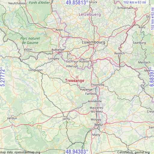
Tressange GPS coordinates[2]
49° 24' 9.756" North, 5° 58' 51.024" East
| Map corner | latitude | longitude |
|---|---|---|
| Upper-left | 49.85813°, | 5.27772° |
| Center: | 49.40271°, | 5.98084° |
| Lower-right: | 48.94303°, | 6.68397° |
| Map W x H: | 101.7×101.7 km | = 63.2×63.2mi |
| max Lat: | 51.07786° ⇑12.1% North |
| Tressange: | 49.40271° |
| min Lat: | ⇓87.9% South 41.3874° |
| min Long | Tressange | max Long |
| -5.08615° | 5.98084° | 9.52242° |
| W 86.9%⇐ | ⇒13.1% E |
Elevation
Elevation of Tressange is 339 m = 1112 ft, and this is 145.3 m = 477 ft above average elevation for this country.
| Max E: |
2333 m = 7654 ft | 15.7% |
| Tressange | 339 m 1112 ft | |
| Avg. | 193.7 m = 635 ft | |
Min E: |
-1 m = -3 ft | 84.3% |
See also: France elevation on elevation.city.
Geographical zone
Tressange is located in North temperate zone (between Tropic of Cancer and the Arctic Circle). Distance of this North polar circle is 1908.1 km =1185.6 mi to North.| Distance of | km | miles | from Tressange |
|---|---|---|---|
| North Pole | 4514 | 2804.9 | to North |
| Arctic Circle | 1908.1 | 1185.6 | to North |
| Tropic Cancer | 2887.1 | 1794 | to South |
| Equator | 5493.1 | 3413.3 | to South |


Nearby cities:
15 places around Tressange: (largest is in red/bold)
• Algrange
6.7 km =4.2 mi,  131°
131°
• Angevillers
4.9 km =3 mi,  109°
109°
• Audun-le-Roman
7.2 km =4.5 mi,  239°
239°
• Audun-le-Tiche
7.9 km =4.9 mi,  346°
346°
• Aumetz
3.1 km =1.9 mi,  302°
302°
• Boulange
3.2 km =2 mi,  224°
224°
• Crusnes
5.9 km =3.7 mi,  306°
306°
• Errouville
5.8 km =3.6 mi,  284°
284°
• Escherange
6.8 km =4.2 mi,  77°
77°
• Fontoy
5.3 km =3.3 mi,  170°
170°
• Knutange
8.2 km =5.1 mi,  149°
149°
• Nilvange
8.4 km =5.2 mi,  143°
143°
• Ottange
5.3 km =3.3 mi,  32°
32°
• Serrouville
6.7 km =4.2 mi,  266°
266°
• Villerupt
8 km =5 mi,  333°
333°
Sources, notices
• [Note1] Compared only with cities in France existing in our database
• [Src1] Map data: © OpenStreetMap contributors (CC-BY-SA)
• [Src2] Other city data from geonames.org with taken over terms of usage.
• [Src3] Geographical zone / Annual Mean Temperature by Robert A. Rohde @ Wikipedia
