Orschwihr geodata
Orschwihr (Grand Est) is a populated place; located in France in Europe/Paris (GMT+2) time zone. With population of 961 people, there are 9120 cities with bigger population in this country. Compared to other cities in France, 58.2% of cities are located further ↓South; 96% of cities are located further ←West and 76.5% of cities have lower elevation than Orschwihr. Note1
Administrative division(s):
- Level 1: Grand Est
- Level 2: Haut-Rhin
- Level 3: Arrondissement de Thann-Guebwiller
- Level 4: Orschwihr


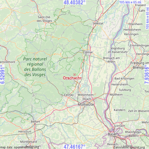
Orschwihr GPS coordinates[2]
47° 56' 5.604" North, 7° 13' 58.944" East
| Map corner | latitude | longitude |
|---|---|---|
| Upper-left | 48.40382°, | 6.52991° |
| Center: | 47.93489°, | 7.23304° |
| Lower-right: | 47.46167°, | 7.93616° |
| Map W x H: | 104.8×104.8 km | = 65.1×65.1mi |
| max Lat: | 51.07786° ⇑41.8% North |
| Orschwihr: | 47.93489° |
| min Lat: | ⇓58.2% South 41.3874° |
| min Long | Orschwihr | max Long |
| -5.08615° | 7.23304° | 9.52242° |
| W 96%⇐ | ⇒4% E |
Elevation
Elevation of Orschwihr is 260 m = 853 ft, and this is 66.3 m = 218 ft above average elevation for this country.
| Max E: |
2333 m = 7654 ft | 23.5% |
| Orschwihr | 260 m 853 ft | |
| Avg. | 193.7 m = 635 ft | |
Min E: |
-1 m = -3 ft | 76.5% |
See also: France elevation on elevation.city.
Geographical zone
Orschwihr is located in North temperate zone (between Tropic of Cancer and the Arctic Circle). Distance of this North polar circle is 2071.3 km =1287 mi to North.| Distance of | km | miles | from Orschwihr |
|---|---|---|---|
| North Pole | 4677.2 | 2906.3 | to North |
| Arctic Circle | 2071.3 | 1287 | to North |
| Tropic Cancer | 2723.9 | 1692.6 | to South |
| Equator | 5329.9 | 3311.8 | to South |


Nearby cities:
15 places around Orschwihr: (largest is in red/bold)
• Bergholtz
2.3 km =1.4 mi,  153°
153°
• Buhl
3.5 km =2.2 mi,  257°
257°
• Guebwiller
3.2 km =2 mi,  230°
230°
• Gundolsheim
4.6 km =2.9 mi,  96°
96°
• Issenheim
3.8 km =2.4 mi,  157°
157°
• Jungholtz
6.2 km =3.9 mi,  206°
206°
• Lautenbach
5.6 km =3.5 mi,  276°
276°
• Lautenbachzell
6.5 km =4 mi, 276°
• Merxheim
5.3 km =3.3 mi,  119°
119°
• Osenbach
5.8 km =3.6 mi,  348°
348°
• Raedersheim
6.3 km =3.9 mi,  144°
144°
• Rouffach
5.6 km =3.5 mi,  62°
62°
• Soultz-Haut-Rhin
5.2 km =3.2 mi,  183°
183°
• Soultzmatt
3 km =1.9 mi,  6°
6°
• Westhalten
3.2 km =2 mi,  38°
38°
Sources, notices
• [Note1] Compared only with cities in France existing in our database
• [Src1] Map data: © OpenStreetMap contributors (CC-BY-SA)
• [Src2] Other city data from geonames.org with taken over terms of usage.
• [Src3] Geographical zone / Annual Mean Temperature by Robert A. Rohde @ Wikipedia
