Jungholtz geodata
Jungholtz (Grand Est) is a populated place; located in France in Europe/Paris (GMT+2) time zone. With population of 692 people, there are 11913 cities with bigger population in this country. Compared to other cities in France, 57.3% of cities are located further ↓South; 95.8% of cities are located further ←West and 83.3% of cities have lower elevation than Jungholtz. Note1
Administrative division(s):
- Level 1: Grand Est
- Level 2: Haut-Rhin
- Level 3: Arrondissement de Thann-Guebwiller
- Level 4: Jungholtz


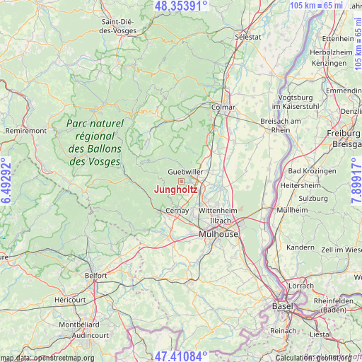
Jungholtz GPS coordinates[2]
47° 53' 4.272" North, 7° 11' 45.744" East
| Map corner | latitude | longitude |
|---|---|---|
| Upper-left | 48.35391°, | 6.49292° |
| Center: | 47.88452°, | 7.19604° |
| Lower-right: | 47.41084°, | 7.89917° |
| Map W x H: | 104.9×104.9 km | = 65.2×65.2mi |
| max Lat: | 51.07786° ⇑42.7% North |
| Jungholtz: | 47.88452° |
| min Lat: | ⇓57.3% South 41.3874° |
| min Long | Jungholtz | max Long |
| -5.08615° | 7.19604° | 9.52242° |
| W 95.8%⇐ | ⇒4.2% E |
Elevation
Elevation of Jungholtz is 326 m = 1070 ft, and this is 132.3 m = 434 ft above average elevation for this country.
| Max E: |
2333 m = 7654 ft | 16.7% |
| Jungholtz | 326 m 1070 ft | |
| Avg. | 193.7 m = 635 ft | |
Min E: |
-1 m = -3 ft | 83.3% |
See also: France elevation on elevation.city.
Geographical zone
Jungholtz is located in North temperate zone (between Tropic of Cancer and the Arctic Circle). Distance of this North polar circle is 2076.9 km =1290.5 mi to North.| Distance of | km | miles | from Jungholtz |
|---|---|---|---|
| North Pole | 4682.8 | 2909.8 | to North |
| Arctic Circle | 2076.9 | 1290.5 | to North |
| Tropic Cancer | 2718.3 | 1689.1 | to South |
| Equator | 5324.3 | 3308.4 | to South |


Nearby cities:
15 places around Jungholtz: (largest is in red/bold)
• Bergholtz
5.2 km =3.2 mi,  46°
46°
• Berrwiller
4.2 km =2.6 mi,  155°
155°
• Bollwiller
5.7 km =3.5 mi,  120°
120°
• Buhl
4.9 km =3 mi,  352°
352°
• Feldkirch
6.2 km =3.9 mi,  110°
110°
• Guebwiller
3.6 km =2.2 mi,  4°
4°
• Hartmannswiller
2.9 km =1.8 mi,  150°
150°
• Issenheim
4.7 km =2.9 mi,  63°
63°
• Lautenbach
6.9 km =4.3 mi,  335°
335°
• Orschwihr
6.2 km =3.9 mi,  26°
26°
• Raedersheim
6.4 km =4 mi,  85°
85°
• Soultz-Haut-Rhin
2.5 km =1.6 mi,  79°
79°
• Uffholtz
7.2 km =4.5 mi,  190°
190°
• Wattwiller
5.5 km =3.4 mi, 194°
• Wuenheim
1.4 km =0.9 mi, 146°
Sources, notices
• [Note1] Compared only with cities in France existing in our database
• [Src1] Map data: © OpenStreetMap contributors (CC-BY-SA)
• [Src2] Other city data from geonames.org with taken over terms of usage.
• [Src3] Geographical zone / Annual Mean Temperature by Robert A. Rohde @ Wikipedia
